Platz an der Vogelstange
Platz an der Vogelstange is in Schmallenberg, Hochsauerlandkreis, North Rhine-Westphalia. Platz an der Vogelstange is situated nearby to the fire station Löschgruppe Kirchrarbach, as well as near the garden Kräutergarten.| Tap on a place to explore it |
Places of Interest Nearby
Highlights include Saint Lambertus Church (Kirchrarbach) and Goldener Strauch.
Saint Lambertus Church (Kirchrarbach)
Church

Photo: S.Didam, CC BY-SA 3.0.
Saint Lambertus Church (Kirchrarbach) is situated 760 metres west of Platz an der Vogelstange.
Goldener Strauch
Peak

Photo: Milseburg, CC BY-SA 3.0.
Goldener Strauch is a peak, which is situated 3 km north of Platz an der Vogelstange.
Places in the Area
Nearby places include Kirchrarbach and Föckinghausen.
Kirchrarbach
Village

Photo: Friedhelm Dröge, CC BY-SA 4.0.
Kirchrarbach is a locality in the municipality Schmallenberg in the district Hochsauerlandkreis in North Rhine-Westphalia, Germany. The village has 273 inhabitants and lies in the north of the municipality of Schmallenberg at a height of around 393 m on the Kreisstraße 38.
Föckinghausen
Hamlet

Photo: S.Didam, CC BY-SA 3.0.
Föckinghausen is a locality in the municipality Schmallenberg in the district Hochsauerlandkreis in North Rhine-Westphalia, Germany. The village has 9 inhabitants and lies in the north of the municipality of Schmallenberg at a height of around 450 m.
Sögtrop
Hamlet
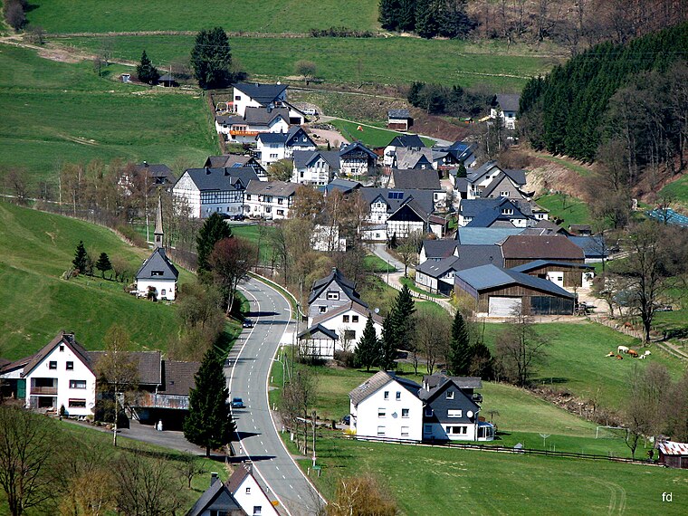
Photo: Friedhelm Dröge, CC BY-SA 4.0.
Sögtrop is a locality in the municipality Schmallenberg in the district Hochsauerlandkreis in North Rhine-Westphalia, Germany. The village has 109 inhabitant and lies in the north of the municipality of Schmallenberg at a height of around 383 m on the Kreisstraße 38.
Platz an der Vogelstange
- Type: Sign
- Categories: information and tourism
- Location: Schmallenberg, Hochsauerlandkreis, Arnsberg, South Westphalia, North Rhine-Westphalia, Germany, Central Europe, Europe
- View on OpenStreetMap
Latitude
51.25384° or 51° 15′ 14″ northLongitude
8.3083° or 8° 18′ 30″ eastOpen location code
9F3C7835+G8OpenStreetMap ID
node 6917906421OpenStreetMap feature
tourism=information
This page is based on OpenStreetMap, Wikidata, and Wikimedia Commons.
We’d love your help improving our open data sources. Thank you for contributing.
Satellite Map
Discover Platz an der Vogelstange from above in high-definition satellite imagery.
Notable Places Nearby
Highlights include Löschgruppe Kirchrarbach and Kräutergarten.
Nearby Places
Explore places such as Vogelstange and Auf´m Brauke.
South Westphalia: Must-Visit Destinations
Delve into Siegen, Iserlohn, Soest, and Lüdenscheid.
Curious Places to Discover
Uncover intriguing places from every corner of the globe.
About Mapcarta. Data © OpenStreetMap contributors and available under the Open Database License". Text is available under the CC BY-SA 4.0 license, except for photos, directions, and the map. Photo: Wikimedia, CC0.