Handschuhpeter
Handschuhpeter is a clothing store in Landstraße, Vienna which is located on Landstraßer Hauptstraße. Handschuhpeter is situated nearby to the bunker MAK Tower, as well as near the art gallery Atelier Lori Rosenberg.| Tap on a place to explore it |
- Opening hours:
Monday—Friday: 10:00 AM—12:30 PM and 1:00 PM—6:00 PM
Saturday: 10:00 AM—2:00 PM - Type: Clothing store
- Address: Landstraßer Hauptstraße 83-85, Wien, 1030
- Wheelchair access: limited
Places of Interest Nearby
Highlights include University of Music and Performing Arts Vienna and Belvedere.
University of Music and Performing Arts Vienna
University

Photo: Wikimedia, Public domain.
The University of Music and Performing Arts Vienna is an Austrian university established in 1817 located in Vienna. With a student body of over three thousand, it is the largest institution of its kind in Austria, and one of the largest in the world. University of Music and Performing Arts Vienna is situated 650 metres west of Handschuhpeter.
Belvedere
Park
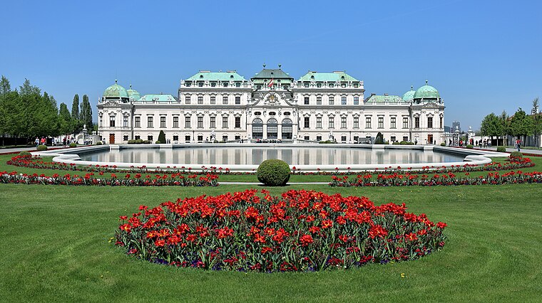
Photo: Bwag, CC BY-SA 4.0.
The Belvedere is a historic building complex in Vienna, Austria consisting of two Baroque palaces, the Orangery, and the Palace Stables. The buildings are set in a Baroque park landscape in the third district of the city, on the south-eastern edge of its centre. Belvedere is situated 1¼ km southwest of Handschuhpeter.
Hundertwasserhaus

Photo: Bwag, CC BY-SA 4.0.
The Hundertwasserhaus is an apartment house in Vienna, Austria, completed in 1985, after the idea and concept of Austrian artist Friedensreich Hundertwasser. Hundertwasserhaus is situated 1 km north of Handschuhpeter.
Places in the Area
Nearby places include Erdberg and Pratercottage.


Handschuhpeter
- Category: shop
- Location: Landstraße, Vienna, Austria, Central Europe, Europe
- View on OpenStreetMap
Latitude
48.19983° or 48° 11′ 59″ northLongitude
16.39386° or 16° 23′ 38″ eastOpen location code
8FWR59XV+WGOpenStreetMap ID
node 6918611180OpenStreetMap feature
shop=clothesOpenStreetMap attribute
wheelchair=limited
This page is based on OpenStreetMap, Wikidata, and Wikimedia Commons.
We’d love your help improving our open data sources. Thank you for contributing.
Satellite Map
Discover Handschuhpeter from above in high-definition satellite imagery.
Notable Places Nearby
Highlights include MAK Tower and Volkshochschule Landstraße.
Nearby Places
Explore places such as Kimchi ToGo and Zoofachgeschäft Scharf.
Vienna: Must-Visit Destinations
Delve into Innere Stadt, Vienna International Airport, Inner East, and Alsergrund.
Curious Clothing Stores to Discover
Uncover intriguing clothing stores from every corner of the globe.
About Mapcarta. Data © OpenStreetMap contributors and available under the Open Database License". Text is available under the CC BY-SA 4.0 license, except for photos, directions, and the map. Photo: Miguel Mendez, CC BY 2.0.