Luta de Serpentes
Luta de Serpentes is a work of art in Santa Cruz de Tenerife, Tenerife. Luta de Serpentes is situated nearby to the fountain La granja 1 y 2, as well as near the outdoor gym Zona de Calistenia.| Tap on a place to explore it |
Places of Interest Nearby
Highlights include Parque de La Granja and Estadio Heliodoro Rodríguez López.
Parque de La Granja
Park
 The Parque de La Granja is a park in Santa Cruz de Tenerife, Canary Islands, Spain. It was built between 1969 and 1976. It is a wide area designated for sports, games, rides to admire the flora and more.
Estadio Heliodoro Rodríguez López
Stadium

Photo: Edub, CC BY-SA 2.0.
Estadio Heliodoro Rodriguez Lopez also Estadio de Tenerife is a football stadium in Santa Cruz de Tenerife, Tenerife, Canary Islands, Spain. It is the home ground of CD Tenerife. Estadio Heliodoro Rodríguez López is situated 480 metres east of Luta de Serpentes.
Auditorio de Tenerife
Arts center
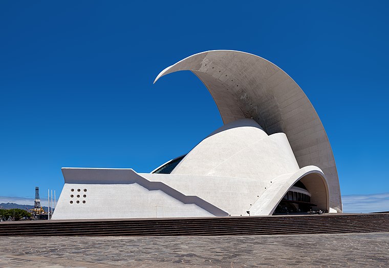
Photo: Der Wolf im Wald, CC BY-SA 3.0 de.
The Auditorio de Tenerife "Adán Martín" is an auditorium in Santa Cruz de Tenerife, Canary Islands, Spain. Designed by architect Santiago Calatrava, it is located on the Avenue of the Constitution in the Canarian capital, and next to the Atlantic Ocean in the southern part of Port of Santa Cruz de Tenerife. Auditorio de Tenerife is situated 1½ km southeast of Luta de Serpentes.
Places in the Area
Nearby places include El Chapatal and Buenavista.


Luta de Serpentes
- Type: Work of art
- Artwork type: sculpture
- Category: tourism
- Location: Santa Cruz de Tenerife, Santa Cruz de Tenerife, Tenerife, Canary Islands, Spain, Iberia, Europe
- View on OpenStreetMap
Latitude
28.46219° or 28° 27′ 44″ northLongitude
-16.26525° or 16° 15′ 55″ westInception
1994Open location code
7CW5FP6M+VWOpenStreetMap ID
node 6932177506OpenStreetMap feature
tourism=artworkOpenStreetMap attribute
artwork_type=sculpture
This page is based on OpenStreetMap, Wikidata, and Wikimedia Commons.
We’d love your help improving our open data sources. Thank you for contributing.
Satellite Map
Discover Luta de Serpentes from above in high-definition satellite imagery.
Notable Places Nearby
Highlights include La granja 1 y 2 and Zona de Calistenia.
Nearby Places
Explore places such as Kocora and Avenida de Madrid.
Tenerife: Must-Visit Destinations
Delve into San Cristóbal de La Laguna, Teide National Park, Puerto de la Cruz, and Candelaria.
Curious Work Of Arts to Discover
Uncover intriguing work of arts from every corner of the globe.
About Mapcarta. Data © OpenStreetMap contributors and available under the Open Database License". Text is available under the CC BY-SA 4.0 license, except for photos, directions, and the map. Photo: Wikimedia, CC BY-SA 3.0.