Töüfrüüdli
Töüfrüüdli is a locality in Wilderswil, Interlaken-Oberhasli, Canton of Bern. Töüfrüüdli is situated nearby to the locality Uf der Louenen, as well as near Im nüwe Rächt.| Tap on a place to explore it |
Places of Interest
Highlights include Interlaken Airport and Wilderswil railway station.
Interlaken Airport
Aerodrome

Photo: calflier001, CC BY-SA 2.0.
Interlaken Airport is a former military airbase in Interlaken, Switzerland. The airbase is now closed to scheduled commercial flights.
Wilderswil railway station
Railway station

Photo: Andrewrabbott, Public domain.
Wilderswil railway station is a railway station in the village and municipality of Wilderswil in the Swiss canton of Bern. The station is on the Berner Oberland Bahn, whose trains operate services to Interlaken Ost, Grindelwald and Lauterbrunnen.
Breitlauenen railway station
Railway station

Photo: SalomonCeb, CC BY-SA 3.0.
Breitlauenen is a railway station on the Schynige Platte railway, a rack railway that connects Wilderswil with the Schynige Platte in the Bernese Oberland region of Switzerland.
Places in the Area
Nearby places include Matten bei Interlaken and Bönigen.
Matten bei Interlaken
Village
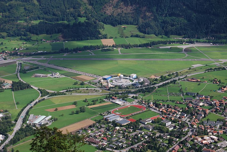
Photo: DidiWeidmann, CC BY-SA 3.0.
Matten bei Interlaken is a village and municipality in the Interlaken-Oberhasli administrative district in the canton of Bern in Switzerland. Matten b.I. belongs to the Small Agglomeration Interlaken with 23,300 inhabitants.
Bönigen
Village
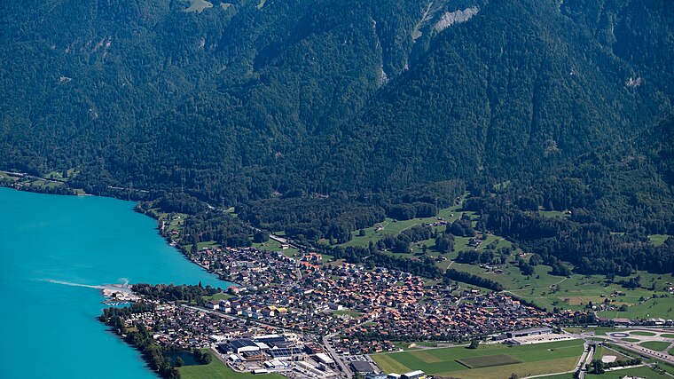
Photo: Espandero, CC BY-SA 4.0.
Bönigen is a village and municipality in the Interlaken-Oberhasli administrative district in the Swiss canton of Bern. It lies on the shore of Lake Brienz, near to the mouth of the river Lütschine, and adjacent to the resort town of Interlaken.
Interlaken
 Interlaken is a small city in the Bernese Highlands region of central Switzerland. Located between two alpine lakes, Interlaken is a popular base camp for outdoor sports and travel in the surrounding Bernese Oberland Alps.
Töüfrüüdli
- Type: Locality
- Location: Wilderswil, Interlaken-Oberhasli, Canton of Bern, Switzerland, Central Europe, Europe
- View on OpenStreetMap
Latitude
46.6705° or 46° 40′ 14″ northLongitude
7.88138° or 7° 52′ 53″ eastOpen location code
8FR9MVCJ+5GOpenStreetMap ID
node 6942775053OpenStreetMap feature
place=locality
This page is based on OpenStreetMap, Wikidata, and Wikimedia Commons.
We’d love your help improving our open data sources. Thank you for contributing.
Satellite Map
Discover Töüfrüüdli from above in high-definition satellite imagery.
Localities in the Area
Explore places such as Uf der Louenen and Im nüwe Rächt.
Notable Places Nearby
Highlights include Tennispark Jungfrau AG and Schiessstand Bönigen.
Switzerland: Must-Visit Destinations
Delve into Zurich, Berne, Geneva, and Basel.
Curious Localities to Discover
Uncover intriguing localities from every corner of the globe.
About Mapcarta. Data © OpenStreetMap contributors and available under the Open Database License". Text is available under the CC BY-SA 4.0 license, except for photos, directions, and the map. Photo: Simonizer, CC BY-SA 2.0 de.