Einstieg und Ausstieg für Kanus
Einstieg und Ausstieg für Kanus is a slipway in Oberriexingen, Ludwigsburg, Baden-Württemberg. Einstieg und Ausstieg für Kanus is situated nearby to the park Ennery-Platz, as well as near the sports venue Sporthalle Oberriexingen.| Tap on a place to explore it |
Places of Interest Nearby
Highlights include Georgskirche and Muckenschupf.
Georgskirche
Church
 Georgskirche is a church, which is situated 450 metres northeast of Einstieg und Ausstieg für Kanus.

Enz Viaduct
Bridge

Photo: Sese Ingolstadt, CC BY-SA 3.0.
Enz Viaduct is a bridge, which is situated 1½ km west of Einstieg und Ausstieg für Kanus.
Places in the Area
Nearby places include Pulverdingen and Unterriexingen.

Unterriexingen
Village

Photo: Pilettes, CC BY-SA 3.0.
Unterriexingen is a village in the district of Ludwigsburg, Baden-Württemberg, Germany. By 1973 it was incorporated to the town of Markgröningen. Unterriexingen is situated 3 km northeast of Einstieg und Ausstieg für Kanus.
Enzweihingen
Village
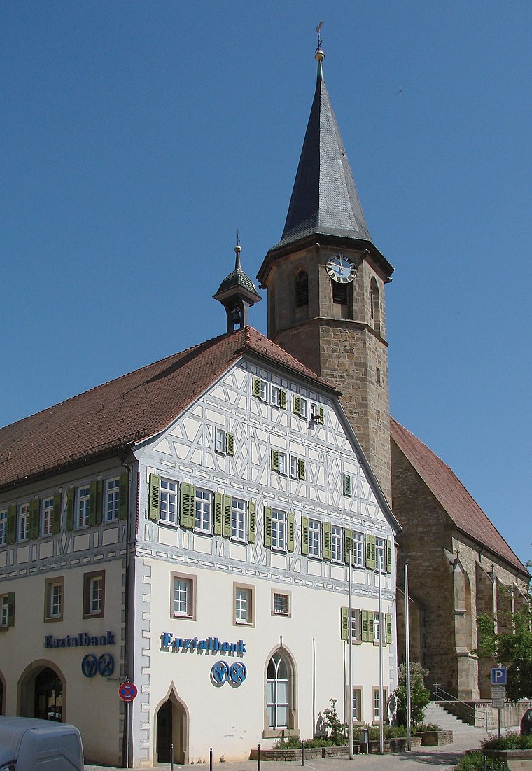
Photo: Mussklprozz, CC BY-SA 3.0.
Enzweihingen is a village, part of the town of Vaihingen an der Enz, Germany. It has a population of 3,951 people. Enzweihingen lies about three miles southeast of the centre of Vaihingen, between Strohgäu and Heckengäu, at the confluence of the Kreuzbach, Strudelbach and Enz. Enzweihingen is situated 3 km west of Einstieg und Ausstieg für Kanus.
Einstieg und Ausstieg für Kanus
- Type: Slipway
- Categories: recreation area and transportation
- Location: Oberriexingen, Ludwigsburg, Stuttgart, Baden-Württemberg, Germany, Central Europe, Europe
- View on OpenStreetMap
Latitude
48.92345° or 48° 55′ 24″ northLongitude
9.02305° or 9° 1′ 23″ eastOpen location code
8FWFW2FF+96OpenStreetMap ID
node 696427059OpenStreetMap feature
leisure=slipway
This page is based on OpenStreetMap, Wikidata, and Wikimedia Commons.
We’d love your help improving our open data sources. Thank you for contributing.
Satellite Map
Discover Einstieg und Ausstieg für Kanus from above in high-definition satellite imagery.
Places with the Same Name
Discover other places named “Einstieg und Ausstieg für Kanus”.
Notable Places Nearby
Highlights include Ennery-Platz and Sporthalle Oberriexingen.
Nearby Places
Explore places such as Festhalle Oberriexingen and Einstieg für Kanus.
Baden-Württemberg: Must-Visit Destinations
Delve into Stuttgart, Heidelberg, Karlsruhe, and Mannheim.
Curious Slipways to Discover
Uncover intriguing slipways from every corner of the globe.
About Mapcarta. Data © OpenStreetMap contributors and available under the Open Database License". Text is available under the CC BY-SA 4.0 license, except for photos, directions, and the map. Photo: Traveler100, CC BY-SA 3.0.