Martin Freundlich
Martin Freundlich is a memorial in Hamburg, Hamburg. Martin Freundlich is situated nearby to the community center Jugendclub Eimsbüttel, as well as near the health club Mudō Werkstatt.| Tap on a place to explore it |
Places of Interest Nearby
Highlights include Christuskirche and Christuskirche station.
Christuskirche
Church

Photo: Dirtsc, CC BY-SA 3.0.
Christuskirche is a church, which is situated 290 metres southeast of Martin Freundlich.
Christuskirche station
Metro station

Photo: NordNordWest, CC BY-SA 3.0 de.
Christuskirche is a metro station on the Hamburg U-Bahn line U2. The underground station was opened in June 1913 and is located in the Hamburg district of Eimsbüttel, Germany. Eimsbüttel is center of the Hamburg borough of Eimsbüttel. Christuskirche station is situated 340 metres southeast of Martin Freundlich.
Rote Flora
Community center
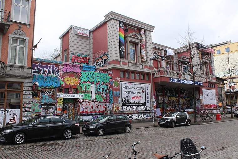
Photo: Hinnerk11, CC BY-SA 4.0.
The Rote Flora is a former theatre in the Sternschanze district of Hamburg, Germany. It has been squatted since November 1989 as a self-managed social centre. Rote Flora is situated 1 km south of Martin Freundlich.
Places in the Area
Nearby places include Eimsbüttel and Hoheluft-West.
Eimsbüttel
Suburb

Photo: Bernhard Diener, CC BY-SA 4.0.
Eimsbüttel is one of the seven boroughs of Hamburg, Germany. In 2020, the borough had a population of 269,118.

Harvestehude
Suburb

Photo: Poupou l’quourouce, CC BY-SA 3.0.
Harvestehude is a quarter of Hamburg, Germany, in the borough of Eimsbüttel. It is located on the eastern boundaries of the borough near lake Außenalster.
Martin Freundlich
- Type: Memorial
- Category: historic site
- Location: Hamburg, Hamburg, Freie und Hansestadt, Hamburg, Germany, Central Europe, Europe
- View on OpenStreetMap
Latitude
53.57177° or 53° 34′ 18″ northLongitude
9.9589° or 9° 57′ 32″ eastNetwork
Stolpersteine HamburgOpen location code
9F5FHXC5+PHOpenStreetMap ID
node 699792320OpenStreetMap feature
historic=memorial
This page is based on OpenStreetMap, Wikidata, and Wikimedia Commons.
We’d love your help improving our open data sources. Thank you for contributing.
Satellite Map
Discover Martin Freundlich from above in high-definition satellite imagery.
Notable Places Nearby
Highlights include Jugendclub Eimsbüttel and Mudō Werkstatt.
Nearby Places
Explore places such as Charlotte Freundlich geb. Behrendt and Bäckerei Wulf.
Hamburg: Must-Visit Destinations
Delve into Altona-St. Pauli, Neustadt-Altstadt, East Hamburg, and North Hamburg.
Curious Memorials to Discover
Uncover intriguing memorials from every corner of the globe.
About Mapcarta. Data © OpenStreetMap contributors and available under the Open Database License". Text is available under the CC BY-SA 4.0 license, except for photos, directions, and the map. Photo: Joerg Moellenkamp, CC BY 2.0.