Der Fußkuss
Der Fußkuss is a work of art in Waltershausen, Gotha, Thuringia. Der Fußkuss is situated nearby to the church St. Peter und Paul (Schnepfenthal), as well as near the sports venue Historischer Turnplatz.| Tap on a place to explore it |
Places of Interest Nearby
Highlights include St. Peter und Paul (Schnepfenthal) and Forest Cemetery Schnepfenthal.
St. Peter und Paul (Schnepfenthal)
Church

Photo: Metilsteiner, CC BY 3.0.
St. Peter und Paul (Schnepfenthal) is a church.
Forest Cemetery Schnepfenthal
Cemetery

Photo: Metilsteiner, CC BY-SA 3.0.
Forest Cemetery Schnepfenthal is situated 160 metres northeast of Der Fußkuss.

Places in the Area
Nearby places include Schnepfenthal and Rödichen.
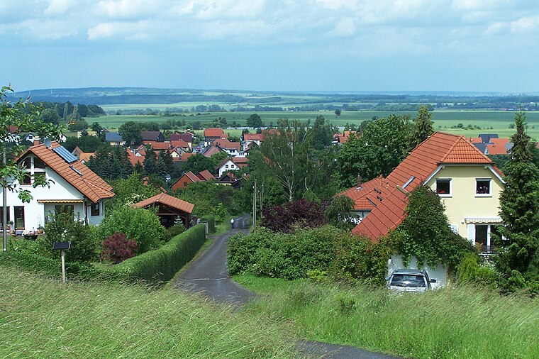

Waltershausen
Town

Photo: Wikimedia, CC BY-SA 4.0.
Waltershausen is a town in the south-western part of the district of Gotha in the state of Thuringia, Germany.
Der Fußkuss
- Type: Work of art
- Artwork type: sculpture
- Category: tourism
- Location: Waltershausen, Gotha, Thuringia, Germany, Central Europe, Europe
- View on OpenStreetMap
Latitude
50.88172° or 50° 52′ 54″ northLongitude
10.57967° or 10° 34′ 47″ eastOpen location code
9F2GVHJH+MVOpenStreetMap ID
node 7019086807OpenStreetMap feature
tourism=artworkOpenStreetMap attribute
artwork_type=sculpture
This page is based on OpenStreetMap, Wikidata, and Wikimedia Commons.
We’d love your help improving our open data sources. Thank you for contributing.
Satellite Map
Discover Der Fußkuss from above in high-definition satellite imagery.
Notable Places Nearby
Highlights include Historischer Turnplatz and GutsMuths-Gedächtnishalle.
Nearby Places
Explore places such as Zur Tanne and Mühle Schnepfenthal.
Curious Work Of Arts to Discover
Uncover intriguing work of arts from every corner of the globe.
About Mapcarta. Data © OpenStreetMap contributors and available under the Open Database License". Text is available under the CC BY-SA 4.0 license, except for photos, directions, and the map. Photo: Taxiarchos228, FAL.