Uvala Jezero
Uvala Jezero is a bay in Municipality of Pakoštane, Zadar County.| Tap on a place to explore it |
Places of Interest
Highlights include Arta Velika and Vransko Jezero Nature Park.
Arta Velika
Island
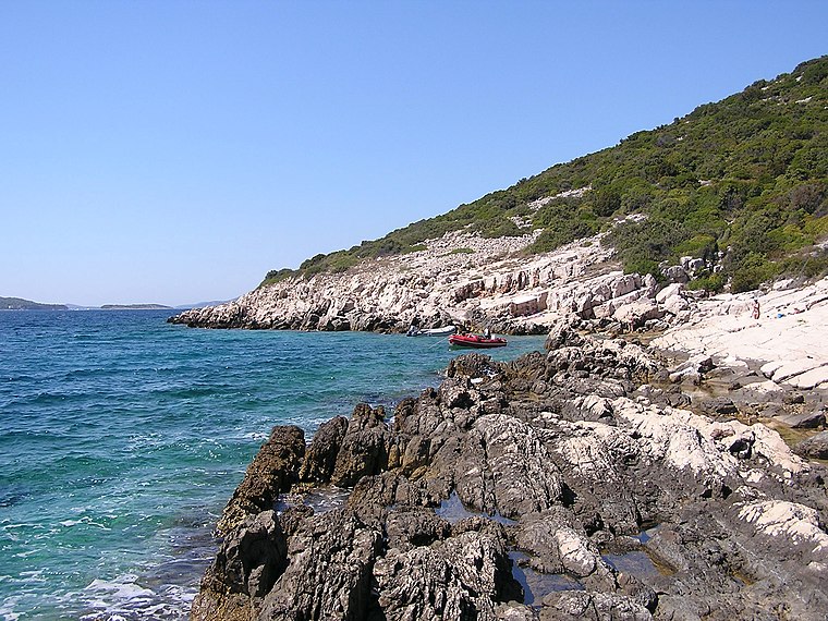 Arta Velika is an uninhabited island in Croatia, in central Dalmatia, part of the Šibenik archipelago off the coast of the city of Šibenik. It lies 2.5 km northwest of the island of Murter and the settlement nearest to the island is Pakoštane, 5 km away on the mainland.
Vransko Jezero Nature Park
Nature reserve

Photo: *fiedler*, CC BY-SA 3.0.
Vransko Jezero Nature Park is a nature reserve.

Places in the Area
Nearby places include Murter and Biograd na Moru.
Murter

Photo: Tadeáš Cvrček, CC BY-SA 3.0.
Murter is an island in the Croatian part of the Adriatic sea, located in central Dalmatia. A small village on the north-western part of the island also bears the name.
Biograd na Moru

Photo: Wikimedia, CC BY-SA 3.0.
Biograd na Moru, shortened to simply Biograd, is a town in northern Dalmatia in Croatia. It is significant for being another capital of the medieval Kingdom of Croatia.
Pakoštane
Village

Photo: Einer flog zu Weit, CC BY-SA 3.0.
Pakoštane is a village and municipality in Croatia, located in Zadar County. It is a tourist town with many gravel beaches and pine woods.
Uvala Jezero
- Type: Bay
- Category: body of water
- Location: Municipality of Pakoštane, Zadar County, Croatia, Balkans, Europe
- View on OpenStreetMap
Latitude
43.8958° or 43° 53′ 45″ northLongitude
15.5524° or 15° 33′ 9″ eastOpen location code
8FMQVHW2+8XOpenStreetMap ID
node 7024363917OpenStreetMap feature
natural=bay
This page is based on OpenStreetMap, Wikidata, and Wikimedia Commons.
We’d love your help improving our open data sources. Thank you for contributing.
Satellite Map
Discover Uvala Jezero from above in high-definition satellite imagery.
Places with the Same Name
Discover other places named “Uvala Jezero”.
Localities in the Area
Explore places such as Drage, Pakoštane and Martina draga.
Notable Places Nearby
Highlights include crkva svetog Ante and Velika Čelinka.
Croatia: Must-Visit Destinations
Delve into Zagreb, Dubrovnik, Split, and Rijeka.
Curious Bays to Discover
Uncover intriguing bays from every corner of the globe.
About Mapcarta. Data © OpenStreetMap contributors and available under the Open Database License". Text is available under the CC BY-SA 4.0 license, except for photos, directions, and the map. Photo: Wikimedia, CC BY-SA 3.0.