Narsarsuaq
Narsarsuaq is a bus stop in Sermersooq, Greenland. Narsarsuaq is situated nearby to the church Salvation Army, as well as near Nuuk Art Museum.| Tap on a place to explore it |
Places of Interest Nearby
Highlights include Nuuk Art Museum and Katuaq Culture Centre.
Nuuk Art Museum
Museum
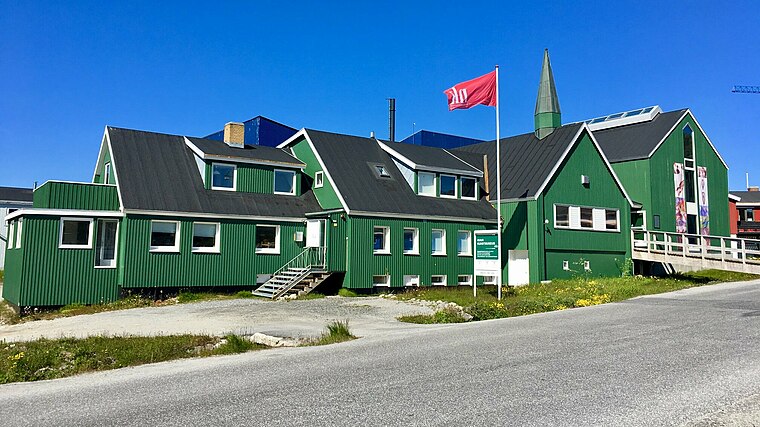
Photo: C.rosing.nuuk, CC BY-SA 4.0.
Nuuk Art Museum is a local museum in Greenland, located in Nuuk, the capital. The museum contains a notable collection of paintings, watercolors, drawings, graphics, figures in soapstone, ivory, and wood, with many items collected by the businessman Svend Junge.
Katuaq Culture Centre
Theater building

Photo: Alankomaat, Public domain.
Katuaq is a cultural centre in Nuuk, Greenland. It is used for concerts, exhibitions, conferences, and as a cinema. Designed by Schmidt Hammer Lassen, it was constructed as a joint project of the Greenland Home Rule Government, the Nuuk Municipal Council and the Nordic Council of Ministers and was inaugurated on 15 February 1997. Katuaq Culture Centre is situated 440 metres west of Narsarsuaq.
Godthåbhallen
Sports venue
 Godthåbhallen is a handball stadium in Nuuk, Greenland. It is the home of the Greenland men's national handball team. The stadium has a capacity of 1,000 people. Godthåbhallen is situated 150 metres northeast of Narsarsuaq.
Places in the Area
Nearby places include Nuuk Centrum and Old Nuuk.
Nuuk Centrum
Suburb
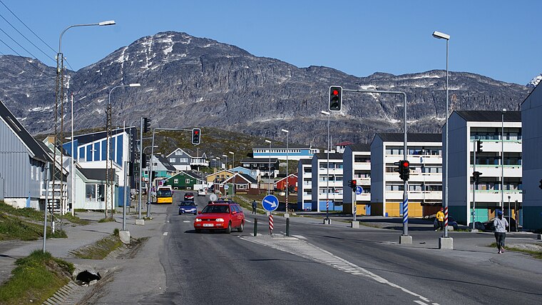
Photo: Algkalv, CC BY-SA 3.0.
Nuuk Centrum is a district of Nuuk, the capital of Greenland. Together with the Old Nuuk neighborhood, it encompasses the southern and central part of the town. Most of the institutions and businesses are based in the district.
Old Nuuk
Neighborhood

Photo: Wikimedia, Public domain.
Old Nuuk may refer to several neighborhoods of Nuuk, the capital of Greenland. The Lutheran mission was originally based on Hope Island at the head of the fjord but was moved to the mainland and christened Godthaab by the royal governor Claus Paarss in 1728.
Nuuk
 Nuuk, also known by its Danish name of Godthåb, is the capital and administrative centre of Greenland, with a population of around 15,000. The city is sometimes accused of being rather soulless, with many high-rise blocks.
Narsarsuaq
- Type: Bus stop
- Category: transportation
- Location: Sermersooq, Greenland, North America
- View on OpenStreetMap
Latitude
64.17716° or 64° 10′ 38″ northLongitude
-51.73002° or 51° 43′ 48″ westOperator
Bus.glOpen location code
98PC57G9+VXOpenStreetMap ID
node 7025526045OpenStreetMap feature
highway=bus_stopOpenStreetMap feature
public_transport=platform
This page is based on OpenStreetMap, Wikidata, and Wikimedia Commons.
We’d love your help improving our open data sources. Thank you for contributing.
Satellite Map
Discover Narsarsuaq from above in high-definition satellite imagery.
Places with the Same Name
Discover other places named “Narsarsuaq”.
Notable Places Nearby
Highlights include Salvation Army and Skøjtebanen.
Nearby Places
Explore places such as Narsarsuaq and Mary’s Kitchen.
Greenland: Must-Visit Destinations
Delve into Nuuk, Ilulissat, Northeast Greenland National Park, and Sisimiut.
Curious Bus Stops to Discover
Uncover intriguing bus stops from every corner of the globe.
About Mapcarta. Data © OpenStreetMap contributors and available under the Open Database License". Text is available under the CC BY-SA 4.0 license, except for photos, directions, and the map. Photo: Slaunger, CC BY-SA 3.0.