Abilene Police Department
Abilene Police Department is a police station in Taylor, Texas. Abilene Police Department is situated nearby to the courthouse Abilene Municipal Court, as well as near the government office Texas Department of Public Safety.| Tap on a place to explore it |
Places of Interest Nearby
Highlights include Abilene High School.
Abilene High School
School
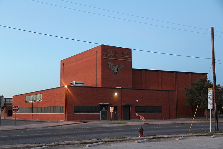
Photo: Flofor15, CC BY-SA 3.0.
Abilene High School is a public high school located in Abilene, Texas. AHS is classified as a Division 5A school and is part of the Abilene Independent School District. Abilene High School is situated 1½ miles east of Abilene Police Department.
Places in the Area
Nearby places include Abilene and Impact.
Abilene

Photo: Wikimedia, CC BY-SA 3.0.
Abilene is a city in the North Central Plains of Texas, possibly best known as the destination the fictional family of the Abilene paradox travels to.
Impact
Hamlet
Impact is a town in Taylor County, Texas, United States. The population was 22 as of the 2020 census, down from 35 at the 2010 census, making it the second least populated municipality in Texas. Impact is situated 4 miles northeast of Abilene Police Department.
Tye
Village
Tye is a city in Taylor County, Texas, United States. Its population was 1,176 at the 2020 census. It is part of the Abilene, Texas metropolitan statistical area. Tye is situated 5 miles west of Abilene Police Department.
Abilene Police Department
- Type: Police station
- Address: Abilene, TX
- Location: Taylor, Texas, United States, North America
- View on OpenStreetMap
Latitude
32.44917° or 32° 26′ 57″ northLongitude
-99.78187° or 99° 46′ 55″ westOpen location code
8642C6X9+M7OpenStreetMap ID
node 7036303813OpenStreetMap feature
amenity=police
This page is based on OpenStreetMap, Wikidata, and Wikimedia Commons.
We’d love your help improving our open data sources. Thank you for contributing.
Satellite Map
Discover Abilene Police Department from above in high-definition satellite imagery.
Places with the Same Name
Discover other places named “Abilene Police Department”.
Notable Places Nearby
Highlights include Abilene Municipal Court and Texas Department of Public Safety.
Nearby Places
Explore places such as Water Department and Metro Care Ambulance.
Texas: Must-Visit Destinations
Delve into Houston, Austin, Dallas, and San Antonio.
Curious Police Stations to Discover
Uncover intriguing police stations from every corner of the globe.
About Mapcarta. Data © OpenStreetMap contributors and available under the Open Database License". Text is available under the CC BY-SA 4.0 license, except for photos, directions, and the map. Photo: Wikimedia, CC0.