Healthful Hill
Healthful Hill is a hamlet in Pamphret, Saint Thomas Parish. Healthful Hill is situated nearby to the hamlet Craighton Hall, as well as near Montrose.| Tap on a place to explore it |
Places in the Area
Nearby places include Aeolus Valley and Morant Bay.
Aeolus Valley
Hamlet
Gimme-Me-Bit is a settlement within the parish of Clarendon in the south of Jamaica. It is approximately 5km west of Hayes and 9km southwest from the parish capital of May Pen. Aeolus Valley is situated 6 km west of Healthful Hill.
Morant Bay
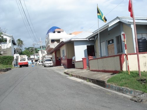
Photo: IchHier--15er, CC BY-SA 3.0 de.
Morant Bay is a town in southeastern Jamaica and the capital of the parish of St. Thomas, located about 40 kilometres east of Kingston, the capital. The parish has a population of 94,410.
Yallahs
Village
Yallahs, a town on the southeastern coast of Jamaica in the parish of St Thomas, is home to approximately 10,000 residents. The city, which was documented as “Yealoth” in a 1662 census, may have derived its name from Captain Yallahs, a privateer from 1671, or vice versa. Yallahs is situated 8 km west of Healthful Hill.
Healthful Hill
- Type: Hamlet
- Category: locality
- Location: Pamphret, Saint Thomas Parish, Jamaica, Caribbean, North America
- View on OpenStreetMap
Latitude
17.88694° or 17° 53′ 13″ northLongitude
-76.48548° or 76° 29′ 8″ westOpen location code
7795VGP7+QROpenStreetMap ID
node 7067931894OpenStreetMap feature
place=hamlet
This page is based on OpenStreetMap, Wikidata, and Wikimedia Commons.
We’d love your help improving our open data sources. Thank you for contributing.
Satellite Map
Discover Healthful Hill from above in high-definition satellite imagery.
Localities in the Area
Explore places such as Craighton Hall and Montrose.
Notable Places Nearby
Highlights include Creighton Hall Cave and The White Horses.
Jamaica: Must-Visit Destinations
Delve into Kingston, Montego Bay, Portmore, and Blue Mountains.
Curious Hamlets to Discover
Uncover intriguing hamlets from every corner of the globe.
About Mapcarta. Data © OpenStreetMap contributors and available under the Open Database License". Text is available under the CC BY-SA 4.0 license, except for photos, directions, and the map. Photo: papushin, CC BY-SA 2.0.