Mihlaer Höhe
Mihlaer Höhe is a peak in Amt Creuzburg, Wartburgkreis, Thuringia and has an elevation of 248 metres. Mihlaer Höhe is situated nearby to the locality (ehem.) Vorw. ‘Münsterkirchen’, as well as near the village Freitagszella.| Tap on a place to explore it |
Places of Interest
Highlights include Grey Castle and Rotes Schloss Mihla.


Places in the Area
Nearby places include Mihla and Lauterbach.
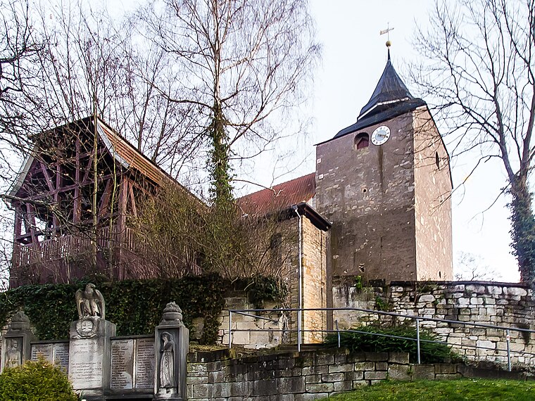
Mihla
Village

Photo: Metilsteiner, CC BY 3.0.
Mihla is a village and a former municipality in the Wartburgkreis district of Thuringia, Germany. Since December 2019, it has been part of the town Amt Creuzburg.
Lauterbach
Village

Photo: Metilsteiner, CC BY 3.0.
Lauterbach is a municipality in the Wartburgkreis district of Thuringia, Germany.
Bischofroda
Village

Photo: Metilsteiner, CC BY-SA 3.0.
Bischofroda is a municipality in the Wartburgkreis district of Thuringia, Germany.
Mihlaer Höhe
- Type: Peak with an elevation of 248 metres
- Category: landform
- Location: Amt Creuzburg, Wartburgkreis, Thuringia, Germany, Central Europe, Europe
- View on OpenStreetMap
Latitude
51.0698° or 51° 4′ 11″ northLongitude
10.3219° or 10° 19′ 19″ eastElevation
248 metres (814 feet)Open location code
9F3G389C+WQOpenStreetMap ID
node 7105668369OpenStreetMap feature
natural=peak
This page is based on OpenStreetMap, Wikidata, and Wikimedia Commons.
We’d love your help improving our open data sources. Thank you for contributing.
Satellite Map
Discover Mihlaer Höhe from above in high-definition satellite imagery.
Localities in the Area
Explore places such as (ehem.) Vorw. ‘Münsterkirchen’ and Freitagszella.
Notable Places Nearby
Highlights include Mittelberg and Spielplatz ‘Am Hainberg’.
Curious Peaks to Discover
Uncover intriguing peaks from every corner of the globe.
About Mapcarta. Data © OpenStreetMap contributors and available under the Open Database License". Text is available under the CC BY-SA 4.0 license, except for photos, directions, and the map. Photo: Taxiarchos228, FAL.