West Medford
West Medford is a railway stop in City of Medford, Middlesex, Massachusetts. West Medford is situated nearby to Saint Raphael Church, as well as near the fire station Medford Fire Department Station 2.| Tap on a place to explore it |
Places of Interest Nearby
Highlights include West Medford station and Shepherd Brooks Estate.
West Medford station
Railway station

Photo: Magicpiano, CC BY-SA 4.0.
West Medford station is an MBTA Commuter Rail station located at West Medford Square in Medford, Massachusetts. It is served by the Lowell Line. The station has low-level platforms with mini-high platforms for accessibility.
Shepherd Brooks Estate
Nature reserve

Photo: Magicpiano, CC BY-SA 4.0.
The Shepherd Brooks Estate is a historic property at 275 Grove Street in Medford, Massachusetts, United States. The 82-acre property is owned by the city of Medford, and managed by a trust established to preserve the property.
Oak Grove Cemetery
Cemetery

Photo: Schdyscout, CC BY-SA 4.0.
Oak Grove Cemetery is situated 3,400 feet north of West Medford.
Places in the Area
Nearby places include West Medford and Medford Hillside.


Hillside Avenue Historic District
Neighborhood
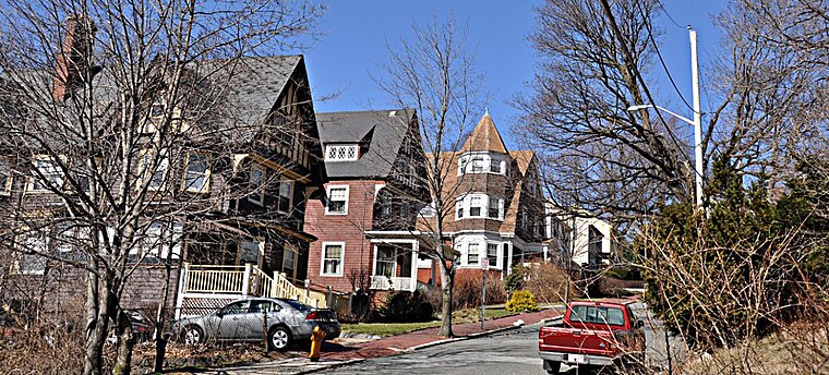
Photo: Magicpiano, CC BY-SA 4.0.
The Hillside Avenue Historic District of Medford, Massachusetts encompasses a well-preserved late 19th-century residential subdivision. It consists of fifteen properties on Hillside and Grand View Avenues, near the downtown area of the city.
West Medford
- Type: Railway stop
- Categories: transport stop and transportation
- Location: City of Medford, Middlesex, Massachusetts, New England, United States, North America
- View on OpenStreetMap
Latitude
42.42228° or 42° 25′ 20″ northLongitude
-71.13393° or 71° 8′ 2″ westNetwork
MBTAOpen location code
87JCCVC8+WCOpenStreetMap ID
node 7110605541OpenStreetMap feature
public_transport=stop_positionOpenStreetMap feature
railway=stop
This page is based on OpenStreetMap, Wikidata, and Wikimedia Commons.
We’d love your help improving our open data sources. Thank you for contributing.
Satellite Map
Discover West Medford from above in high-definition satellite imagery.
Places with the Same Name
Discover other places named “West Medford”.
Notable Places Nearby
Highlights include West Medford Post Office and Saint Raphael Church.
Nearby Places
Explore places such as West Medford Station Parking and Walgreens.
Massachusetts: Must-Visit Destinations
Delve into Boston, Cambridge, Springfield, and Downtown Boston.
Curious Railway Stops to Discover
Uncover intriguing railway stops from every corner of the globe.
About Mapcarta. Data © OpenStreetMap contributors and available under the Open Database License". Text is available under the CC BY-SA 4.0 license, except for photos, directions, and the map. Photo: papadunes, CC BY-SA 3.0.