The River Highway
The River Highway is in Ontario, Canada. The River Highway is situated nearby to LeBreton Flats Park, as well as near Canadian War Museum.| Tap on a place to explore it |
Places of Interest Nearby
Highlights include Canadian War Museum and Library and Archives Canada.
Canadian War Museum
Museum
 The Canadian War Museum is a national museum on the country's military history in Ottawa, Ontario, Canada. The museum serves as both an educational facility on Canadian military history and a place of remembrance. Canadian War Museum is situated 280 metres northeast of The River Highway.
Library and Archives Canada
Library
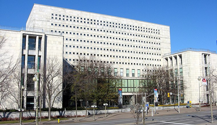
Photo: Wikimedia, CC BY-SA 3.0.
Library and Archives Canada is the federal institution tasked with acquiring, preserving, and providing accessibility to the documentary heritage of Canada. Library and Archives Canada is situated 1 km northeast of The River Highway.
Chaudière Falls
Scenic viewpoint

Photo: Wikimedia, Public domain.
The Chaudière Falls, also known as the Kana:tso or Akikodjiwan Falls, are a set of cascades and waterfall in the centre of the Ottawa-Gatineau metropolitan area in Canada where the Ottawa River narrows between a rocky escarpment on both sides of the river. Chaudière Falls is situated 460 metres north of The River Highway.
Places in the Area
Nearby places include Chinatown and Mechanicsville.
Chinatown
Neighborhood

Photo: Nndd, CC BY-SA 4.0.
Ottawa's Chinatown is located along Somerset Street west of downtown Ottawa. It runs from Bay Street in the east to Preston Street in the west. Signs for Chinatown continue along Somerset until Preston Street, and Chinese/Asian restaurants can be found even farther west.
Mechanicsville
Neighborhood

Photo: P199, CC BY-SA 4.0.
Mechanicsville is a neighbourhood in Kitchissippi Ward in central Ottawa, Ontario, Canada. It is located to the west of downtown and bordered by the Ottawa River to the north, O-Train Line 2 to the east, Scott Street to the south, and Parkdale Avenue to the west.
The River Highway
- Type: Sign
- Categories: information and tourism
- Location: Ontario, Canada, North America
- View on OpenStreetMap
Latitude
45.41542° or 45° 24′ 56″ northLongitude
-75.72° or 75° 43′ 12″ westOpen location code
87Q6C78J+52OpenStreetMap ID
node 7157220785OpenStreetMap feature
tourism=information
This page is based on OpenStreetMap, Wikidata, and Wikimedia Commons.
We’d love your help improving our open data sources. Thank you for contributing.
Satellite Map
Discover The River Highway from above in high-definition satellite imagery.
Notable Places Nearby
Highlights include LeBreton Flats Park and Canada Central Railway Bridge.
Nearby Places
Explore places such as Canoe and A landscape that echoes the past.
Ontario: Must-Visit Destinations
Delve into Toronto, Ottawa, Hamilton, and London.
Curious Places to Discover
Uncover intriguing places from every corner of the globe.
About Mapcarta. Data © OpenStreetMap contributors and available under the Open Database License". Text is available under the CC BY-SA 4.0 license, except for photos, directions, and the map. Photo: Wikimedia, CC BY-SA 2.0.