Huawei Technologies (Ireland)
Huawei Technologies (Ireland) is an office in Dublin, Leinster which is located on Townsend Street. Huawei Technologies (Ireland) is situated nearby to the apartment building Countess Markiewicz House, as well as near the pitch Saint Columcille’s Park.| Tap on a place to explore it |
- Type: Business
- Address: Townsend Street
- Wheelchair access: yes
Places of Interest Nearby
Highlights include Library of Trinity College Dublin and National Library of Ireland.
Library of Trinity College Dublin
Library

Photo: Wikimedia, CC BY-SA 3.0.
The Library of Trinity College Dublin, informally known as the Old Library, is the main library that serves Trinity College, and is the largest library in Ireland. Library of Trinity College Dublin is situated 440 metres southwest of Huawei Technologies (Ireland).
National Library of Ireland
Library
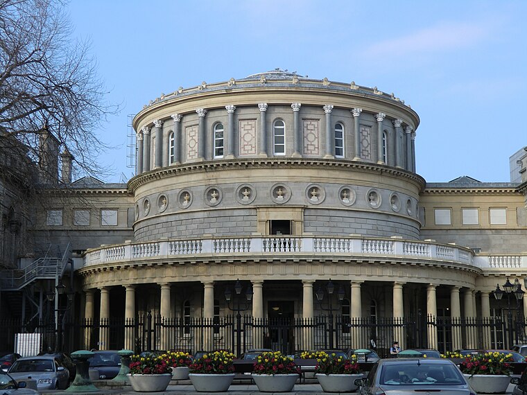
Photo: YvonneM, CC BY-SA 3.0.
The National Library of Ireland is Ireland's national library located in Dublin, in a building designed by Thomas Newenham Deane. The mission of the National Library of Ireland is "To collect, preserve, promote and make accessible the documentary and… National Library of Ireland is situated 570 metres southwest of Huawei Technologies (Ireland).
Dublin Pearse
Railway station

Photo: Barcex, CC BY-SA 3.0.
Pearse railway station or Dublin Pearse is a railway station on Westland Row on the Southside of Dublin, Ireland. It is Ireland's busiest commuter station and second busiest station overall with 9 million passenger journeys through the station in 2016. Dublin Pearse is situated 320 metres southeast of Huawei Technologies (Ireland).
Places in the Area
Nearby places include International Financial Services Centre and Temple Bar.
International Financial Services Centre
Quarter

Photo: Sebb, Public domain.
The International Financial Services Centre is an area of central Dublin and part of the CBD established in the 1980s as an urban regeneration area and special economic zone on the derelict state-owned former port authority lands of the reclaimed North Wall and George's Dock areas of the Dublin Docklands.
Temple Bar
Quarter
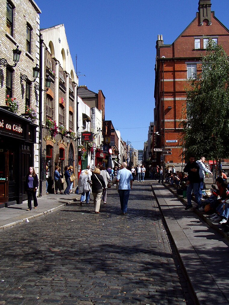
Photo: Wikimedia, Public domain.
Dublin is the capital city of Ireland. Its vibrancy, nightlife and tourist attractions are world renowned and it's the most popular entry point for international visitors to Ireland.
North Wall
Suburb

Photo: DXR, CC BY-SA 4.0.
North Wall is an area east of the inner north side of Dublin, along the River Liffey where it forms one of the Dublin quays. The name refers to the North Bull Wall, which was constructed to form Dublin Port, extend the Liffey estuary and reclaim land at various stages from the early 1700s until its final completion around 1825.
Huawei Technologies (Ireland)
- Category: office
- Location: Dublin, Leinster, Ireland, Britain and Ireland, Europe
- View on OpenStreetMap
Latitude
53.34583° or 53° 20′ 45″ northLongitude
-6.25103° or 6° 15′ 4″ westOpen location code
9C5M8PWX+8HOpenStreetMap ID
node 7191736658OpenStreetMap feature
office=companyOpenStreetMap attribute
wheelchair=yes
This page is based on OpenStreetMap, Wikidata, and Wikimedia Commons.
We’d love your help improving our open data sources. Thank you for contributing.
Satellite Map
Discover Huawei Technologies (Ireland) from above in high-definition satellite imagery.
Notable Places Nearby
Highlights include Countess Markiewicz House and Saint Columcille’s Park.
Nearby Places
Explore places such as Northern Trust and Tesco Express.
Ireland: Must-Visit Destinations
Delve into Cork, Limerick, Galway, and Waterford.
Curious Places to Discover
Uncover intriguing places from every corner of the globe.
About Mapcarta. Data © OpenStreetMap contributors and available under the Open Database License". Text is available under the CC BY-SA 4.0 license, except for photos, directions, and the map. Photo: Wikimedia, CC0.