Застугнянський яр
Застугнянський яр is a scenic viewpoint in Obukhiv Raion, Kyiv Oblast. Застугнянський яр is situated nearby to the scenic viewpoint Вид на Стугну та Васильків, as well as near the cemetery Кладовище ‘Павлова гора’.| Tap on a place to explore it |
Places of Interest Nearby
Highlights include Vasylkiv-Tsentr and 1 Pushkina Street, Vasylkiv.
Vasylkiv-Tsentr
Railway station

Photo: Jbuket, CC BY-SA 3.0.
Vasylkiv-Tsentr is a railway station, which is situated 1½ km northeast of Застугнянський яр.
1 Pushkina Street, Vasylkiv
Historic building

Photo: Oleksandr Mykhaylyk, CC BY-SA 4.0.
1 Pushkina Street, Vasylkiv is a historic building, which is situated 1½ km east of Застугнянський яр.
Saint Nicholas church in Vasylkiv
Church

Photo: Jbuket, CC BY-SA 3.0.
Saint Nicholas church in Vasylkiv is situated 2 km northeast of Застугнянський яр.
Places in the Area
Nearby places include Vasylkiv and Bezpiatne.
Vasylkiv
Town
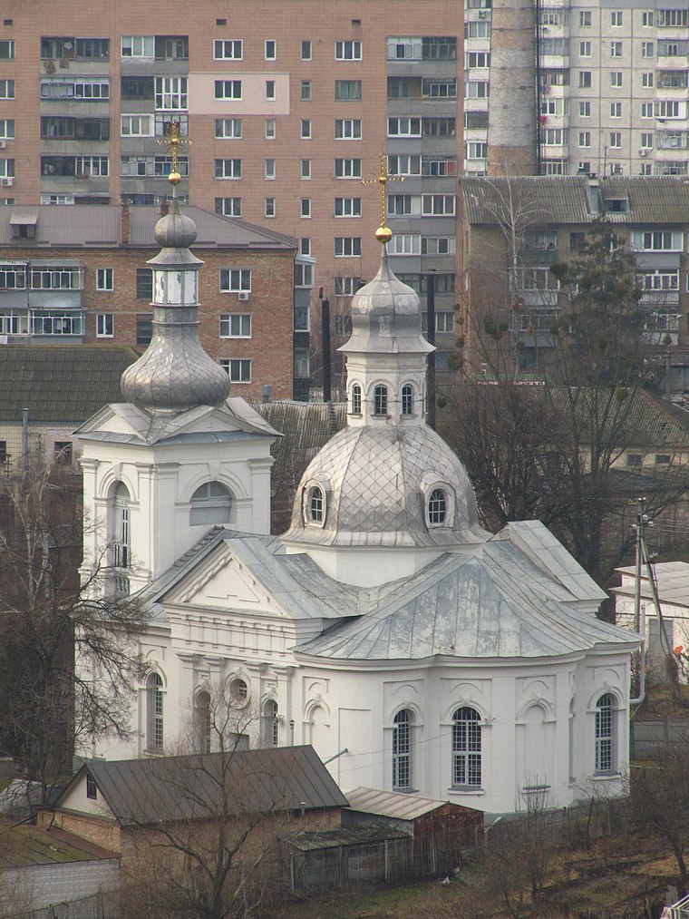
Photo: Jbuket, CC BY-SA 3.0.
Vasylkiv is a city on the Stuhna River in Obukhiv Raion, Kyiv Oblast, central Ukraine. It hosts the administration of Vasylkiv urban hromada, one of the hromadas of Ukraine.
Bezpiatne
Village

Photo: Твердохліб Юлія Ігорівна, CC BY-SA 4.0.
Bezpiatne is a village, which is situated 2½ km west of Застугнянський яр.
Putrivka
Village
Putrivka is a village in the Fastiv Raion, Kyiv Oblast, Ukraine. It belongs to Hlevakha settlement hromada, one of the hromadas of Ukraine. The village has a population of 1,567. Putrivka is situated 4½ km northwest of Застугнянський яр.
Застугнянський яр
- Type: Scenic viewpoint
- Category: tourism
- Location: Obukhiv Raion, Kyiv Oblast, Ukraine, Eastern Europe, Europe
- View on OpenStreetMap
Latitude
50.16779° or 50° 10′ 4″ northLongitude
30.29566° or 30° 17′ 44″ eastOpen location code
9G2G579W+47OpenStreetMap ID
node 7206320110OpenStreetMap feature
tourism=viewpoint
This page is based on OpenStreetMap, Wikidata, and Wikimedia Commons.
We’d love your help improving our open data sources. Thank you for contributing.
Satellite Map
Discover Застугнянський яр from above in high-definition satellite imagery.
In Other Languages
“Застугнянський яр” goes by many names.
- Ukrainian: “Застугнянський яр”
Notable Places Nearby
Highlights include Вид на Стугну та Васильків and Кладовище ‘Павлова гора’.
Nearby Places
Explore places such as Форсаж and Тарік.
Curious Scenic Viewpoints to Discover
Uncover intriguing scenic viewpoints from every corner of the globe.
About Mapcarta. Data © OpenStreetMap contributors and available under the Open Database License". Text is available under the CC BY-SA 4.0 license, except for photos, directions, and the map. Photo: Chern038, CC BY-SA 3.0.