Wriessnig-Kreuz
Wriessnig-Kreuz is a wayside cross in Eberstein, Sankt Veit an der Glan District, Carinthia. Wriessnig-Kreuz is situated nearby to the peak Hornisskogel, as well as near Tangertkogel.| Tap on a place to explore it |
Places of Interest Nearby
Highlights include Wallfahrtskirche von Hochfeistritz and Schloss Eberstein.
Wallfahrtskirche von Hochfeistritz
Church

Photo: Johann Jaritz, CC BY-SA 3.0 at.
Wallfahrtskirche von Hochfeistritz is a church, which is situated 2 km southeast of Wriessnig-Kreuz.
Schloss Eberstein
Castle

Photo: Mefusbren69, Public domain.
Schloss Eberstein is a castle, which is situated 2½ km northwest of Wriessnig-Kreuz.
Friedhof Eberstein
Cemetery

Photo: Johann Jaritz, CC BY-SA 3.0 at.
Friedhof Eberstein is a cemetery, which is situated 2 km northwest of Wriessnig-Kreuz.
Places in the Area
Nearby places include St. Ulrich am Johannserberg and Diex.
St. Ulrich am Johannserberg
Hamlet

Photo: Johann Jaritz, CC BY-SA 4.0.
St. Ulrich am Johannserberg is a hamlet, which is situated 5 km south of Wriessnig-Kreuz.
Diex
Village

Photo: Johann Jaritz, CC BY-SA 4.0.
Diex is a town in the district of Völkermarkt in Austrian state of Carinthia. It is known for its Gothic fortified church on a hilltop. Diex is situated 6 km southeast of Wriessnig-Kreuz.
Grafenbach
Village
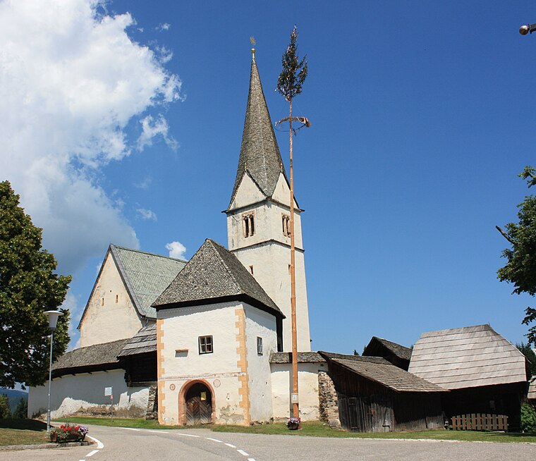
Photo: Mefusbren69, Public domain.
Grafenbach is a village, which is situated 8 km southeast of Wriessnig-Kreuz.
Wriessnig-Kreuz
- Type: Wayside cross
- Category: historic site
- Location: Eberstein, Sankt Veit an der Glan District, Carinthia, Austria, Central Europe, Europe
- View on OpenStreetMap
Latitude
46.79571° or 46° 47′ 45″ northLongitude
14.58182° or 14° 34′ 55″ eastOpen location code
8FRPQHWJ+7POpenStreetMap ID
node 7237737203OpenStreetMap feature
historic=wayside_cross
This page is based on OpenStreetMap, Wikidata, and Wikimedia Commons.
We’d love your help improving our open data sources. Thank you for contributing.
Satellite Map
Discover Wriessnig-Kreuz from above in high-definition satellite imagery.
Notable Places Nearby
Highlights include Hornisskogel and Tangertkogel.
Nearby Places
Explore places such as Aich and Watscher.
Carinthia: Must-Visit Destinations
Delve into Klagenfurt, Villach, Wörthersee, and Spittal an der Drau.
Curious Wayside Crosses to Discover
Uncover intriguing wayside crosses from every corner of the globe.
About Mapcarta. Data © OpenStreetMap contributors and available under the Open Database License". Text is available under the CC BY-SA 4.0 license, except for photos, directions, and the map. Photo: Wikimedia, CC BY-SA 3.0.