Dias da Silva 2
Dias da Silva 2 is a bus stop in Sé Nova, Santa Cruz, Almedina e São Bartolomeu, Coimbra. Dias da Silva 2 is situated nearby to the police station GNR - Comando Territorial de Coimbra, as well as near the monastery Irmãs Doroteias - Residência de Irmãs (Comunidade de Oração).| Tap on a place to explore it |
Places of Interest Nearby
Highlights include Escola Secundária José Falcão and Pelourinho de Coimbra.
Escola Secundária José Falcão
School

Photo: Joehawkins, CC BY-SA 4.0.
Escola Secundária José Falcão is a school, which is situated 170 metres west of Dias da Silva 2.
Pelourinho de Coimbra

Photo: Carlos Luis M C da Cruz, Public domain.
Pelourinho de Coimbra is situated 480 metres southwest of Dias da Silva 2.
Parque de Santa Cruz
Park

Photo: C goulao, Public domain.
Parque de Santa Cruz is a park, which is situated 550 metres west of Dias da Silva 2.
Places in the Area
Nearby places include Cruzeiros de Celas and Santo António dos Olivais.

Santo António dos Olivais
Suburb
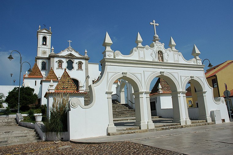
Photo: Wikimedia, CC BY-SA 3.0.
Santo António dos Olivais, commonly shortened to Olivais, is an urban civil parish in the municipality of Coimbra in Portugal, making up the eastern part of the historic city of Coimbra, east of University Hill.
Sé Nova
Neighborhood

Photo: Alvesgaspar, CC BY-SA 3.0.
Sé Nova is a former civil parish in the municipality of Coimbra, Portugal. In 2013, it merged into the new parish Coimbra. Notable landmarks included the New Cathedral of Coimbra and Botanical Garden of the University of Coimbra.
Dias da Silva 2
- Type: Bus stop
- Categories: transport stop and transportation
- Location: Sé Nova, Santa Cruz, Almedina e São Bartolomeu, Coimbra, Coimbra District, Portugal, Iberia, Europe
- View on OpenStreetMap
Latitude
40.21119° or 40° 12′ 40″ northLongitude
-8.4108° or 8° 24′ 39″ westOperator
SMTUCNetwork
SMTUCOpen location code
8CGH6H6Q+FMOpenStreetMap ID
node 7264919944OpenStreetMap feature
public_transport=stop_position
This page is based on OpenStreetMap, Wikidata, and Wikimedia Commons.
We’d love your help improving our open data sources. Thank you for contributing.
Satellite Map
Discover Dias da Silva 2 from above in high-definition satellite imagery.
Places with the Same Name
Discover other places named “Dias da Silva 2”.
Notable Places Nearby
Highlights include GNR - Comando Territorial de Coimbra and Irmãs Doroteias - Residência de Irmãs (Comunidade de Oração).
Nearby Places
Explore places such as Dias da Silva 2 and José Afonso.
Portugal: Must-Visit Destinations
Delve into Lisbon, Caldas da Rainha, Porto, and Braga.
Curious Bus Stops to Discover
Uncover intriguing bus stops from every corner of the globe.
About Mapcarta. Data © OpenStreetMap contributors and available under the Open Database License". Text is available under the CC BY-SA 4.0 license, except for photos, directions, and the map. Photo: Alvesgaspar, CC BY-SA 3.0.