Die Hoffotografen
Die Hoffotografen is a photographer in Berlin, Berlin which is located on Lychener Straße. Die Hoffotografen is situated nearby to the sports venue Tanden Aikido, as well as near the community center SportJugendZentrum Lychi.| Tap on a place to explore it |
- Opening hours: Monday—Friday 10:00 AM—6:00 PM
- Type: Photographer
- Address: Lychener Straße 73, Prenzlauer Berg, Berlin, 10437
Places of Interest Nearby
Highlights include Ausland and Berlin Schönhauser Allee station.
Ausland
Arts center
Ausland is a concert venue and arts location in Berlin, Germany. The venue is well-known as a hub for experimental and improvised music, alongside many other styles, genres, and artistic approaches. Ausland is situated 190 metres south of Die Hoffotografen.
Berlin Schönhauser Allee station
Railway station
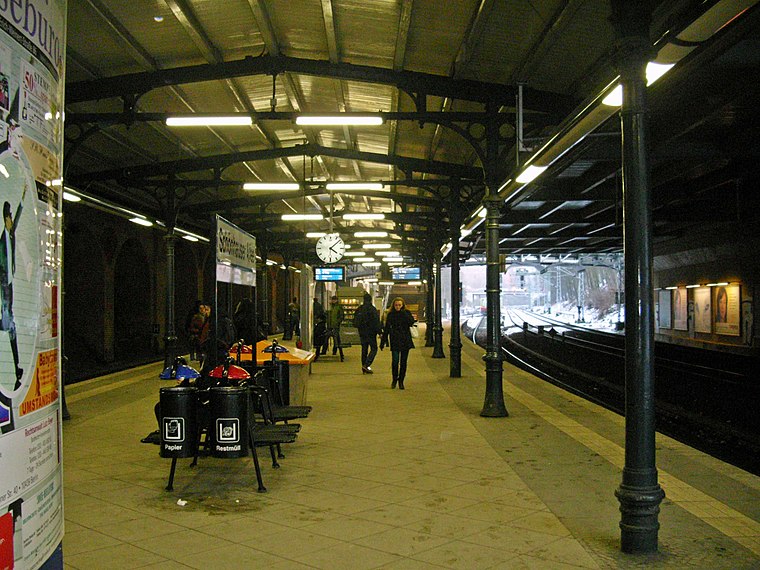
Photo: Auto1234, CC BY-SA 3.0 de.
Berlin Schönhauser Allee is a U-Bahn and S-Bahn railway station in the Prenzlauer Berg district of Berlin, servicing the U2 as well as S-Bahn routes S8, S41, S42, and S85. Berlin Schönhauser Allee station is situated 450 metres northwest of Die Hoffotografen.
Kirche Heilige Familie
Church

Photo: Wikimedia, CC BY-SA 3.0.
Kirche Heilige Familie is a church, which is situated 180 metres north of Die Hoffotografen.
Places in the Area
Nearby places include Helmholtzkiez and Bremer Höhe.


Die Hoffotografen
- Category: workshop
- Location: Berlin, Berlin, Stadt, Berlin, Germany, Central Europe, Europe
- View on OpenStreetMap
Latitude
52.54643° or 52° 32′ 47″ northLongitude
13.42036° or 13° 25′ 13″ eastOpen location code
9F4MGCWC+H4OpenStreetMap ID
node 7280531888OpenStreetMap feature
craft=photographer
This page is based on OpenStreetMap, Wikidata, and Wikimedia Commons.
We’d love your help improving our open data sources. Thank you for contributing.
Satellite Map
Discover Die Hoffotografen from above in high-definition satellite imagery.
Notable Places Nearby
Highlights include Tanden Aikido and SportJugendZentrum Lychi.
Nearby Places
Explore places such as Mischpoke and Netzwerk Spiel/Kultur.
Berlin: Must-Visit Destinations
Delve into Mitte, East Central, City West, and East Berlin.
Curious Photographers to Discover
Uncover intriguing photographers from every corner of the globe.
About Mapcarta. Data © OpenStreetMap contributors and available under the Open Database License". Text is available under the CC BY-SA 4.0 license, except for photos, directions, and the map. Photo: Berthold Werner, CC BY-SA 3.0.