Verde Pinho 2
Verde Pinho 2 is a bus stop in Santo António dos Olivais, Coimbra. Verde Pinho 2 is situated nearby to the health club Ginásio da Arregaça, as well as near the park Parque do Vale das Flores.| Tap on a place to explore it |
Places of Interest Nearby
Highlights include Biblioteca Joanina and Botanical Garden of the University of Coimbra.
Biblioteca Joanina
Library
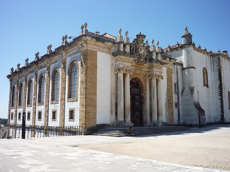
Photo: Chris, CC BY-SA 2.0.
The Biblioteca Joanina, sometimes known in English as the Joanine Library, is a Baroque library in Coimbra, Portugal, located at the heart of the University of Coimbra. Biblioteca Joanina is situated 1½ km northwest of Verde Pinho 2.
Botanical Garden of the University of Coimbra
Park

Photo: Vitor Oliveira, CC BY 2.0.
The Botanical Garden of the University of Coimbra is a botanical garden in Coimbra, Portugal. In 2013, UNESCO declared the university a World Heritage Site, noting its architecture, unique culture and traditions, and historical role, including the botanical garden.
Exploratório - Centro Ciência Viva de Coimbra
Museum

Photo: NelsonCM, CC BY-SA 3.0.
Exploratório - Centro Ciência Viva de Coimbra is a museum, which is situated 1 km west of Verde Pinho 2.
Places in the Area
Nearby places include Sé Nova and Santa Clara.
Sé Nova
Neighborhood

Photo: Alvesgaspar, CC BY-SA 3.0.
Sé Nova is a former civil parish in the municipality of Coimbra, Portugal. In 2013, it merged into the new parish Coimbra. Notable landmarks included the New Cathedral of Coimbra and Botanical Garden of the University of Coimbra.
Santa Clara
Suburb
Santa Clara is a former civil parish in the municipality of Coimbra, Portugal. It was also known as São Francisco or São Francisco da Ponte after its foundation in 1855.

Verde Pinho 2
- Type: Bus stop
- Categories: transport stop and transportation
- Location: Santo António dos Olivais, Coimbra, Coimbra District, Portugal, Iberia, Europe
- View on OpenStreetMap
Latitude
40.19503° or 40° 11′ 42″ northLongitude
-8.41859° or 8° 25′ 7″ westOperator
SMTUCNetwork
SMTUCOpen location code
8CGH5HWJ+2HOpenStreetMap ID
node 7306401985OpenStreetMap feature
public_transport=stop_position
This page is based on OpenStreetMap, Wikidata, and Wikimedia Commons.
We’d love your help improving our open data sources. Thank you for contributing.
Satellite Map
Discover Verde Pinho 2 from above in high-definition satellite imagery.
Notable Places Nearby
Highlights include Ginásio da Arregaça and Parque do Vale das Flores.
Nearby Places
Explore places such as Verde Pinho 2 and Pedro’s Chaves.
Portugal: Must-Visit Destinations
Delve into Lisbon, Caldas da Rainha, Porto, and Braga.
Curious Bus Stops to Discover
Uncover intriguing bus stops from every corner of the globe.
About Mapcarta. Data © OpenStreetMap contributors and available under the Open Database License". Text is available under the CC BY-SA 4.0 license, except for photos, directions, and the map. Photo: Alvesgaspar, CC BY-SA 3.0.