Rua do Luzeiro 3
Rua do Luzeiro 3 is a bus stop in Santo António dos Olivais, Coimbra. Rua do Luzeiro 3 is situated nearby to the sports venue Pavilhão Desportivo de Lordemão, as well as near the park Penedo da Meditação.| Tap on a place to explore it |
Places of Interest Nearby
Highlights include Biblioteca Joanina and Casa-Museu Miguel Torga.
Biblioteca Joanina
Library
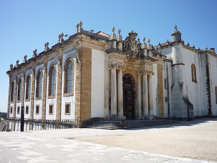
Photo: Chris, CC BY-SA 2.0.
The Biblioteca Joanina, sometimes known in English as the Joanine Library, is a Baroque library in Coimbra, Portugal, located at the heart of the University of Coimbra. Biblioteca Joanina is situated 3½ km southwest of Rua do Luzeiro 3.
Casa-Museu Miguel Torga
Museum

Photo: Threeohsix, CC BY-SA 4.0.
Casa-Museu Miguel Torga is situated 2 km south of Rua do Luzeiro 3.
Monastery of the Holy Cross
Church

Photo: Carlos Luis M C da Cruz, Public domain.
The Monastery of the Holy Cross, also known as the Church of the Holy Cross, is a National Monument in Coimbra, Portugal. Because the first two kings of Portugal are buried in the church it was granted the status of National Pantheon. Monastery of the Holy Cross is situated 3 km southwest of Rua do Luzeiro 3.
Places in the Area
Nearby places include Santo António dos Olivais and São Paulo de Frades.
Santo António dos Olivais
Suburb
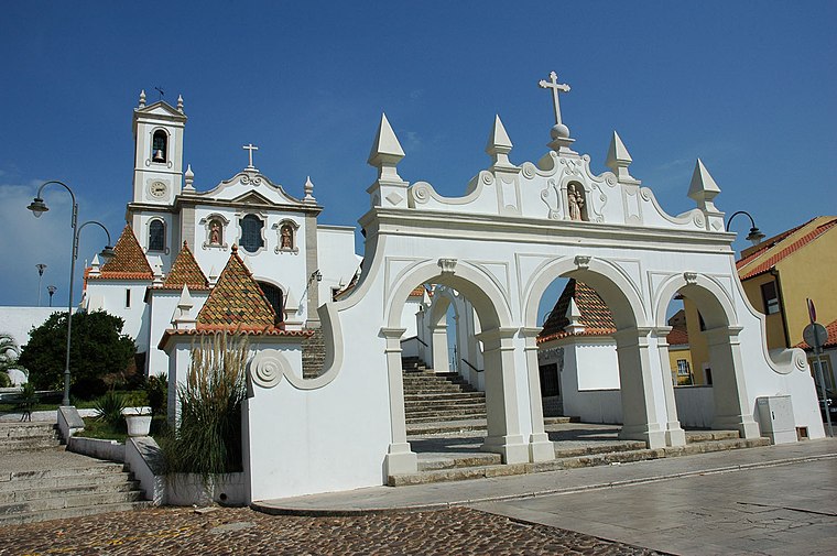
Photo: Wikimedia, CC BY-SA 3.0.
Santo António dos Olivais, commonly shortened to Olivais, is an urban civil parish in the municipality of Coimbra in Portugal, making up the eastern part of the historic city of Coimbra, east of University Hill.
São Paulo de Frades
Village
São Paulo de Frades is a former civil parish in the municipality of Coimbra, Portugal. The population in 2011 was 5,824, in an area of 14.93 km2. On 28 January 2013 it merged with Eiras to form Eiras e São Paulo de Frades.
Eiras
Village
Eiras is a former civil parish in the municipality of Coimbra, Portugal. The population in 2011 was 12,097, in an area of 9.02 km2. On 28 January 2013 it merged with São Paulo de Frades to form Eiras e São Paulo de Frades.
Rua do Luzeiro 3
- Type: Bus stop
- Category: transportation
- Location: Santo António dos Olivais, Coimbra, Coimbra District, Portugal, Iberia, Europe
- View on OpenStreetMap
Latitude
40.23191° or 40° 13′ 55″ northLongitude
-8.4037° or 8° 24′ 13″ westOperator
SMTUCNetwork
SMTUCOpen location code
8CGH6HJW+QGOpenStreetMap ID
node 7365948096OpenStreetMap feature
highway=bus_stopOpenStreetMap feature
public_transport=platform
This page is based on OpenStreetMap, Wikidata, and Wikimedia Commons.
We’d love your help improving our open data sources. Thank you for contributing.
Satellite Map
Discover Rua do Luzeiro 3 from above in high-definition satellite imagery.
Notable Places Nearby
Highlights include Pavilhão Desportivo de Lordemão and Penedo da Meditação.
Nearby Places
Explore places such as Rua do Luzeiro 3 and Rua do Luzeiro 2.
Portugal: Must-Visit Destinations
Delve into Lisbon, Caldas da Rainha, Porto, and Braga.
Curious Bus Stops to Discover
Uncover intriguing bus stops from every corner of the globe.
About Mapcarta. Data © OpenStreetMap contributors and available under the Open Database License". Text is available under the CC BY-SA 4.0 license, except for photos, directions, and the map. Photo: Alvesgaspar, CC BY-SA 3.0.