Sqaq Sannat
Sqaq Sannat is a parking area in Il-Marsa, Malta. Sqaq Sannat is situated nearby to the church Kingdom Hall of Jehovah’s Witnesses, as well as near the village Marsa.| Tap on a place to explore it |
Places of Interest Nearby
Highlights include Holy Trinity Church and Ħal Saflieni Hypogeum.
Holy Trinity Church
Church

Photo: Brian Harrington Spier, CC BY-SA 2.0.
The Church of the Holy Trinity or simply Trinity Church is a Roman Catholic Parish church located in Marsa, Malta. Holy Trinity Church is situated 250 metres northwest of Sqaq Sannat.
Ħal Saflieni Hypogeum
Museum

Photo: Wikimedia, CC BY-SA 3.0.
The Hypogeum of Ħal Saflieni is a Neolithic subterranean structure dating to the Saflieni phase in Maltese prehistory, located in Paola, Malta. It is often simply referred to as the Hypogeum, literally meaning "underground" in Greek. Ħal Saflieni Hypogeum is situated 1½ km southeast of Sqaq Sannat.
Victor Tedesco Stadium
Stadium

Photo: Chivista, CC BY-SA 4.0.
The Victor Tedesco Stadium is a stadium in Hamrun, Malta. It opened in 1996. It has a capacity of 6,000, with 1,800 seated. It is the home ground of Maltese football club Ħamrun Spartans, who currently play in the Maltese Premier League. Victor Tedesco Stadium is situated 760 metres northwest of Sqaq Sannat.
Places in the Area
Nearby places include Marsa and Blata l-Bajda.
Marsa
Village
Photo: Brian Harrington Spier, CC BY-SA 2.0.
Marsa is a town in the Southern Region of Malta, with a population of 4,401 people as of March 2014. The name Marsa means "the harbour".
Blata l-Bajda
Locality

Photo: Wikimedia, Public domain.
Hamrun is a town in the Southern Region of Malta, with a population of 9,244 as of March 2014.
Paola
Town
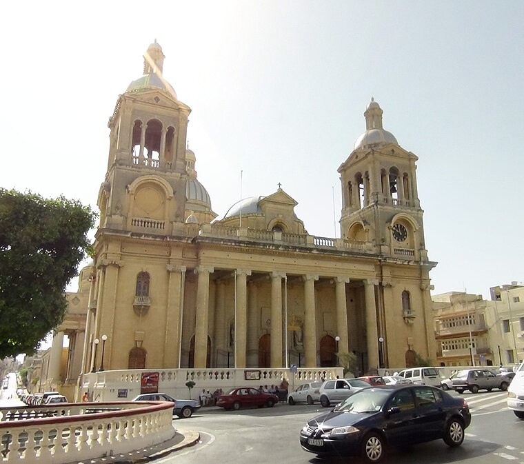
Photo: Sudika, CC BY-SA 3.0.
Paola is a town in the Port Region of Malta, with 8,706 inhabitants as of 2019. The town is a commercial centre in the Southern Harbour area of Malta, about 5 km from the capital Valletta, contiguous to Tarxien and Fgura, with which it forms a single urban area.
Sqaq Sannat
- Type: Parking area
- Category: transportation
- Location: Il-Marsa, Malta, Europe
- View on OpenStreetMap
Latitude
35.88119° or 35° 52′ 52″ northLongitude
14.49613° or 14° 29′ 46″ eastOpen location code
8F7PVFJW+FFOpenStreetMap ID
node 738426089OpenStreetMap feature
amenity=parking
This page is based on OpenStreetMap, Wikidata, and Wikimedia Commons.
We’d love your help improving our open data sources. Thank you for contributing.
Satellite Map
Discover Sqaq Sannat from above in high-definition satellite imagery.
Notable Places Nearby
Highlights include Kingdom Hall of Jehovah’s Witnesses and St. Augustine’s College.
Nearby Places
Explore places such as Balons and Kasarreda.
Malta: Must-Visit Destinations
Delve into Valletta, Mdina, Sliema, and Victoria.
Curious Parking Areas to Discover
Uncover intriguing parking areas from every corner of the globe.
About Mapcarta. Data © OpenStreetMap contributors and available under the Open Database License". Text is available under the CC BY-SA 4.0 license, except for photos, directions, and the map. Photo: Dirk.heldmaier, CC BY-SA 3.0.