Stele mit Altar
Stele mit Altar is a wayside shrine in Cappeln, Cloppenburg, Lower Saxony. Stele mit Altar is situated nearby to the village green Dorfplatz Sevelten, as well as near the recreation area Grüner Pavillion.| Tap on a place to explore it |
Places of Interest Nearby
Highlights include Cloppenburg train station and St. Andreas.
Cloppenburg train station
Railway station
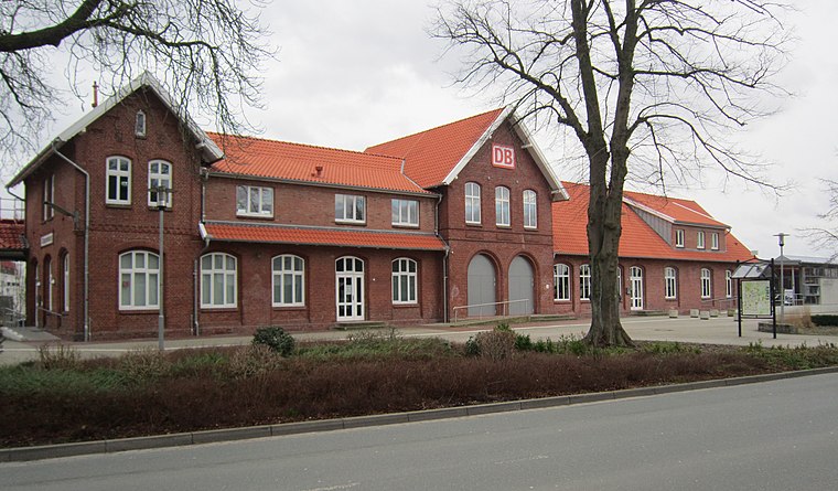
Photo: Corradox, CC BY-SA 4.0.
Cloppenburg train station is a railway station, which is situated 3½ km north of Stele mit Altar.
St. Andreas
Church

Photo: Wikimedia, Copyrighted free use.
St. Andreas is a church, which is situated 4 km northwest of Stele mit Altar.
St. Peter und Paul
Church

Photo: Sichi77, CC BY-SA 4.0.
St. Peter und Paul is a church, which is situated 3½ km east of Stele mit Altar.
Places in the Area
Nearby places include Cloppenburg and Bethen.
Cloppenburg
Town
Photo: Wikimedia, Copyrighted free use.
Cloppenburg is a town in Lower Saxony, in north-western Germany, capital of Cloppenburg District and part of Oldenburg Münsterland. It lies 38 km south-south-west of Oldenburg in the Weser-Ems region between Bremen and the Dutch border. Cloppenburg is situated 4 km north of Stele mit Altar.
Bethen
Hamlet

Photo: Rabanus Flavus, Public domain.
Bethen is a small town on the edge of the German city Cloppenburg in Lower Saxony. It is a Marian shrine, as such first mentioned in 1448. Bethen is situated 6 km north of Stele mit Altar.
Emstek
Village

Photo: Dirk urbansky, CC BY-SA 3.0.
Emstek is a municipality in the district of Cloppenburg, in Lower Saxony, Germany. It is situated approximately 8 km east of Cloppenburg. Emstek is situated 7 km east of Stele mit Altar.
Stele mit Altar
- Type: Wayside shrine
- Denomination: Catholic
- Category: historic site
- Location: Cappeln, Cloppenburg, Lower Saxony, Germany, Central Europe, Europe
- View on OpenStreetMap
Latitude
52.81063° or 52° 48′ 38″ northLongitude
8.05996° or 8° 3′ 36″ eastOpen location code
9F4CR365+7XOpenStreetMap ID
node 741587231OpenStreetMap feature
historic=wayside_shrineOpenStreetMap attribute
denomination=catholic
This page is based on OpenStreetMap, Wikidata, and Wikimedia Commons.
We’d love your help improving our open data sources. Thank you for contributing.
Satellite Map
Discover Stele mit Altar from above in high-definition satellite imagery.
Notable Places Nearby
Highlights include Dorfplatz Sevelten and Grüner Pavillion.
Nearby Places
Explore places such as Infinity Beauty Studio and Hof Lückmann.
Lower Saxony: Must-Visit Destinations
Delve into Hanover, Göttingen, Brunswick, and Wolfsburg.
Curious Wayside Shrines to Discover
Uncover intriguing wayside shrines from every corner of the globe.
About Mapcarta. Data © OpenStreetMap contributors and available under the Open Database License". Text is available under the CC BY-SA 4.0 license, except for photos, directions, and the map. Photo: Danapit, CC BY-SA 3.0.