Heidenkrippe
Heidenkrippe is an archaeological site in Saxony-Anhalt, Germany. Heidenkrippe is situated nearby to the village Bartensleben, as well as near Ivenrode.| Tap on a place to explore it |
Places of Interest Nearby
Highlights include St. Petri and Eimersleben Post Mill.
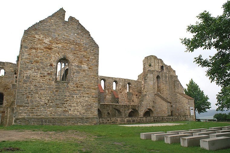
St. Petri
Church

Photo: Olaf2, CC BY-SA 3.0.
St. Petri is a church, which is situated 3 km southeast of Heidenkrippe.
Eimersleben Post Mill
Windmill

Photo: Wikimedia, CC BY-SA 3.0.
Eimersleben Post Mill is a windmill, which is situated 3 km south of Heidenkrippe.
Holländermühle Alleringersleben
Windmill

Photo: Olaf2, CC BY-SA 3.0.
Holländermühle Alleringersleben is a windmill, which is situated 4 km southwest of Heidenkrippe.
Places in the Area
Nearby places include Bartensleben and Ivenrode.
Bartensleben
Village

Photo: flamenc, CC BY-SA 3.0.
Bartensleben is a village and a former municipality in the Börde district in Saxony-Anhalt, Germany. Since 1 January 2010, it is part of the municipality Erxleben. Bartensleben is situated 3½ km west of Heidenkrippe.
Ivenrode
Village
Ivenrode is a village and a former municipality in the Börde district in Saxony-Anhalt, Germany. Since 1 January 2010, it is part of the municipality Altenhausen. Ivenrode is situated 4½ km northeast of Heidenkrippe.
Walbeck
Village
 Walbeck is a village and a former municipality in the Börde district in Saxony-Anhalt, Germany. Since 1 January 2010, it is part of the town Oebisfelde-Weferlingen. Its population is 688. Walbeck is situated 9 km northwest of Heidenkrippe.
Heidenkrippe
- Type: Archaeological site
- Also known as: “Großsteingrab Heidenkrippe”
- Categories: megalithic tomb, historic site, tourist attraction, and tourism
- Location: Saxony-Anhalt, Germany, Central Europe, Europe
- View on OpenStreetMap
Latitude
52.24533° or 52° 14′ 43″ northLongitude
11.1828° or 11° 10′ 58″ eastOpen location code
9F4H65WM+44OpenStreetMap ID
node 7499953242OpenStreetMap feature
historic=archaeological_siteWikidata ID
Q1594179
This page is based on OpenStreetMap, Wikidata, and Wikimedia Commons.
We’d love your help improving our open data sources. Thank you for contributing.
Satellite Map
Discover Heidenkrippe from above in high-definition satellite imagery.
In Other Languages
“Heidenkrippe” goes by many names.
- German: “Großsteingrab Erxleben”
- German: “Heidenkrippe”
Notable Places Nearby
Highlights include Sportplatz Kreuzberg and Springplatz.
Nearby Places
Explore places such as Jagdhütte and Erxleben.
Saxony-Anhalt: Must-Visit Destinations
Delve into Magdeburg, Halle, Wittenberg, and Quedlinburg.
Curious Archaeological Sites to Discover
Uncover intriguing archaeological sites from every corner of the globe.
About Mapcarta. Data © OpenStreetMap contributors and available under the Open Database License". Text is available under the CC BY-SA 4.0 license, except for photos, directions, and the map. Photo: GMM, Public domain.