Arrousaire
Arrousaire is a tram stop in Avignon, Vaucluse, Provence-Alpes-Côte d’Azur. Arrousaire is situated nearby to the bus station Pôle d’Echange Multimodal, as well as near the public building Maison Départementale des Personnes Handicapées.| Tap on a place to explore it |
Places of Interest Nearby
Highlights include Arrousaire–Saint-Ruf and Pont Saint-Bénézet.

Pont Saint-Bénézet

Photo: Chimigi, CC BY-SA 2.0 fr.
The Pont Saint-Bénézet, also known as the Pont d'Avignon, was a medieval bridge across the Rhône in the town of Avignon, in southern France. Only four arches survive. Pont Saint-Bénézet is situated 1½ km north of Arrousaire.
Avignon-Centre station
Railway stop

Photo: Floflo, Public domain.
The gare d'Avignon-Centre is a railway station serving the city of Avignon, in Vaucluse, France. It is on the Paris–Marseille railway. Avignon-Centre station is situated 360 metres west of Arrousaire.
Places in the Area
Nearby places include Ile Piot and Villeneuve-lès-Avignon.

Villeneuve-lès-Avignon
Town
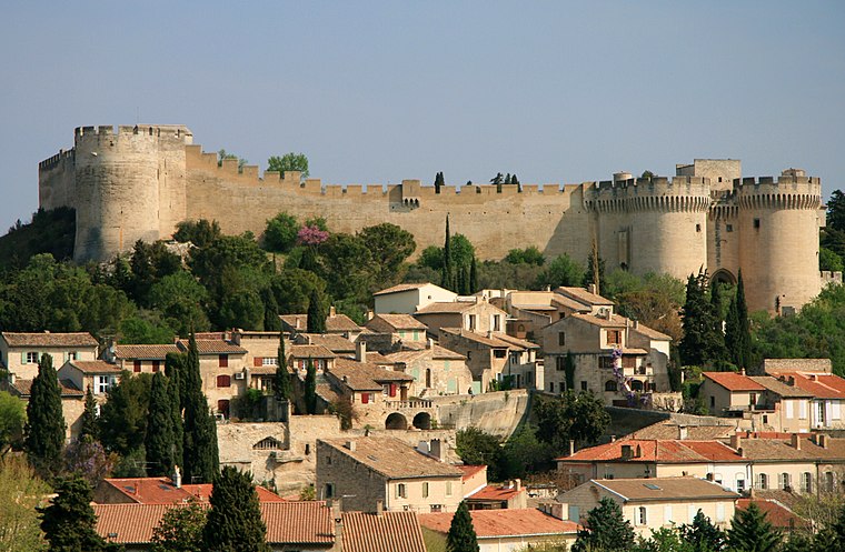
Photo: Luu, CC BY-SA 3.0.
Villeneuve-lès-Avignon is a commune in the Gard department in southern France. It can also be spelled Villeneuve-lez-Avignon. Villeneuve-lès-Avignon is situated 3 km north of Arrousaire.
Rognonas
Village
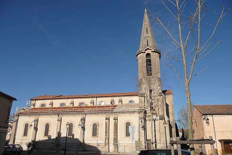
Photo: Wikimedia, CC BY-SA 3.0.
Rognonas is a commune in the Bouches-du-Rhône department in southern France. Rognonas is situated 4½ km south of Arrousaire.
Arrousaire
- Type: Tram stop
- Also known as: “Arrousaire - St-Ruf”
- Categories: railway stop, transport stop, and transportation
- Location: Avignon, Arrondissement of Avignon, Vaucluse, Provence-Alpes-Côte d’Azur, France, Europe
- View on OpenStreetMap
Latitude
43.94066° or 43° 56′ 26″ northLongitude
4.80961° or 4° 48′ 35″ eastInception
October 19th, 2019Open location code
8FM6WRR5+7ROpenStreetMap ID
node 7503282779OpenStreetMap feature
public_transport=stop_positionOpenStreetMap feature
railway=tram_stop
This page is based on OpenStreetMap, Wikidata, and Wikimedia Commons.
We’d love your help improving our open data sources. Thank you for contributing.
Satellite Map
Discover Arrousaire from above in high-definition satellite imagery.
Places with the Same Name
Discover other places named “Arrousaire”.
Notable Places Nearby
Highlights include Pôle d’Echange Multimodal and Maison Départementale des Personnes Handicapées.
Nearby Places
Explore places such as Proman and Association solidarité fraternité ensemble.
Vaucluse: Must-Visit Destinations
Delve into Orange, Carpentras, Cavaillon, and Gordes.
Curious Tram Stops to Discover
Uncover intriguing tram stops from every corner of the globe.
About Mapcarta. Data © OpenStreetMap contributors and available under the Open Database License". Text is available under the CC BY-SA 4.0 license, except for photos, directions, and the map. Photo: Brateevsky, CC BY-SA 3.0.