Les Sources
Les Sources is a tram stop in Avignon, Vaucluse, Provence-Alpes-Côte d’Azur. Les Sources is situated nearby to Esplanade Rosa Parks, as well as near the public building CPAM du Vaucluse.| Tap on a place to explore it |
Photo: Dan.84.F, CC BY-SA 4.0.
Places of Interest Nearby
Highlights include Parc des Sports and Trillade–Médiathèque.
Parc des Sports
Stadium

Photo: Véronique PAGNIER, Public domain.
Parc des Sports is a multi-purpose stadium in Avignon, France. It is currently used mostly for football matches and hosts the home matches of AC Avignonnais. The capacity of the stadium is 17,518 spectators. Parc des Sports is situated 1½ km east of Les Sources.
Trillade–Médiathèque
Tram stop

Photo: Dan.84.F, CC BY-SA 4.0.
Trillade–Médiathèque is a tram stop, which is situated 570 metres west of Les Sources.
Abbey of Saint-Ruf, Avignon
Church

Photo: Wikimedia, CC BY-SA 3.0.
The abbey of Saint-Ruf was a house of canons regular in the city of Avignon between the 11th and 18th centuries. It was the mother house and original headquarters of the Order of Saint-Ruf. After 1158, it was reduced to a priory. Abbey of Saint-Ruf, Avignon is situated 1 km west of Les Sources.
Places in the Area
Nearby places include Ile Piot and Rognonas.
Ile Piot
Locality

Photo: Txllxt TxllxT, CC BY-SA 4.0.
Ile Piot is a locality, which is situated 3½ km northwest of Les Sources.
Rognonas
Village
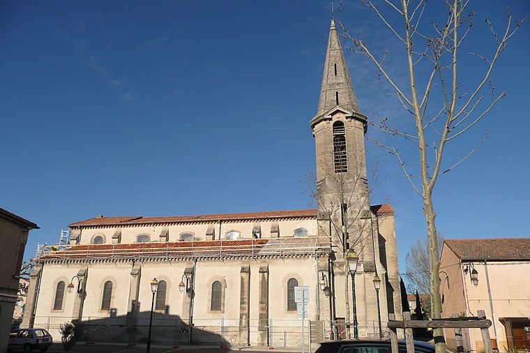
Photo: Wikimedia, CC BY-SA 3.0.
Rognonas is a commune in the Bouches-du-Rhône department in southern France. Rognonas is situated 4 km southwest of Les Sources.
Villeneuve-lès-Avignon
Town
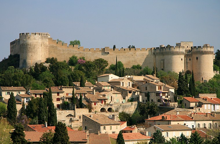
Photo: Luu, CC BY-SA 3.0.
Villeneuve-lès-Avignon is a commune in the Gard department in southern France. It can also be spelled Villeneuve-lez-Avignon. Villeneuve-lès-Avignon is situated 4½ km northwest of Les Sources.
Les Sources
- Type: Tram stop
- Description: tram stop in Avignon, France
- Categories: railway stop, transport stop, and transportation
- Location: Avignon, Arrondissement of Avignon, Vaucluse, Provence-Alpes-Côte d’Azur, France, Europe
- View on OpenStreetMap
Latitude
43.9309° or 43° 55′ 51″ northLongitude
4.82614° or 4° 49′ 34″ eastInception
October 19th, 2019Open location code
8FM6WRJG+9FOpenStreetMap ID
node 7522585890OpenStreetMap feature
public_transport=stop_positionOpenStreetMap feature
railway=tram_stopWikidata ID
Q97386464
This page is based on OpenStreetMap, Wikidata, and Wikimedia Commons.
We’d love your help improving our open data sources. Thank you for contributing.
Satellite Map
Discover Les Sources from above in high-definition satellite imagery.
In Other Languages
From Basque to Spanish—“Les Sources” goes by many names.
- Basque: “Les Sources”
- Catalan: “Les Sources”
- French: “Les Sources”
- Galician: “Les Sources”
- Spanish: “Les Sources”
Places with the Same Name
Discover other places named “Les Sources”.
Notable Places Nearby
Highlights include Esplanade Rosa Parks and CPAM du Vaucluse.
Nearby Places
Explore places such as Les Sources and Les Sources.
Vaucluse: Must-Visit Destinations
Delve into Orange, Carpentras, Cavaillon, and Gordes.
Curious Tram Stops to Discover
Uncover intriguing tram stops from every corner of the globe.
About Mapcarta. Data © OpenStreetMap contributors and available under the Open Database License". Text is available under the CC BY-SA 4.0 license, except for photos, directions, and the map. Photo: Dan.84.F, CC BY-SA 4.0.