Mongallés
Mongallés is a peak in Liédena, Navarre and has an elevation of 573 metres. Mongallés is situated nearby to the locality Santacruz, as well as near Ballesteros.| Tap on a place to explore it |
Places of Interest
Highlights include Castle of Xavier and Church of Santa María la Real.
Castle of Xavier
Castle
 The Castle of Xavier is located on a hill in the town of Xavier, 52 km east of Pamplona and 7 km east of Sangüesa. The town of Xavier was part of the Kingdom of Navarre.
Church of Santa María la Real
Church
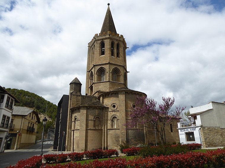
Photo: Millars, CC BY-SA 4.0.
The Church of Santa María la Real is a medieval church located in Sangüesa, Spain. The architecture represents a transitional style between Romanesque and Gothic.

Places in the Area
Nearby places include Liédena and Xavier.
Liédena
Village
 Liédena is a town and municipality located in the province and autonomous community of Navarre, northern Spain.
Xavier
Village

Photo: Gerd Eichmann, CC BY-SA 4.0.
Xavier is a town and municipality located in the province and autonomous community of Navarre, northern Spain, with a population of 112. The name is the Romanized form of the original Etxeberri.

Mongallés
- Type: Peak with an elevation of 573 metres
- Category: landform
- Location: Liédena, Navarre, Northern Spain, Spain, Iberia, Europe
- View on OpenStreetMap
Latitude
42.5945° or 42° 35′ 40″ northLongitude
-1.255° or 1° 15′ 18″ westElevation
573 metres (1,880 feet)Open location code
8CJWHPVV+RXOpenStreetMap ID
node 7611829133OpenStreetMap feature
natural=peak
This page is based on OpenStreetMap, Wikidata, and Wikimedia Commons.
We’d love your help improving our open data sources. Thank you for contributing.
Satellite Map
Discover Mongallés from above in high-definition satellite imagery.
In Other Languages
From Basque to Spanish—“Mongallés” goes by many names.
- Basque: “Ugarte Txiki”
- Spanish: “Mongallés”
Localities in the Area
Explore places such as Santacruz and Mongalles.
Notable Places Nearby
Highlights include Ugaste and Ugarte.
Navarre: Must-Visit Destinations
Delve into Pamplona, Roncesvalles, and Uterga.
Curious Peaks to Discover
Uncover intriguing peaks from every corner of the globe.
About Mapcarta. Data © OpenStreetMap contributors and available under the Open Database License". Text is available under the CC BY-SA 4.0 license, except for photos, directions, and the map. Photo: Artsuaga, CC BY-SA 3.0.