Vernon Boulevard–Jackson Avenue
Vernon Boulevard–Jackson Avenue is a railway stop in Queens, New York. Vernon Boulevard–Jackson Avenue is situated nearby to 108th Precinct Police Station, as well as near the park Vernon Mall.| Tap on a place to explore it |
Places of Interest Nearby
Highlights include Vernon Boulevard–Jackson Avenue station and Vernon Mall.
Vernon Boulevard–Jackson Avenue station
Metro station

Photo: Tdorante10, CC BY-SA 4.0.
The Vernon Boulevard–Jackson Avenue station is a local station on the IRT Flushing Line of the New York City Subway, and the westernmost station on the Queens portion of the line.

United Nations Headquarters

Photo: Superbass, CC BY-SA 4.0.
The headquarters of the United Nations is on 17 to 18 acres of grounds in the Turtle Bay neighborhood of Midtown Manhattan in New York City. It borders First Avenue to the west, 42nd Street to the south, 48th Street to the north, and the East River to the east. United Nations Headquarters is situated 1 mile northwest of Vernon Boulevard–Jackson Avenue.
Places in the Area
Nearby places include Long Island City and Astoria and Tudor City.
Long Island City and Astoria
 Long Island City is a neighborhood within the New York City borough of Queens. It is bordered by Astoria to the north; the East River to the west; Sunnyside to the east; and Newtown Creek, which separates Queens from Greenpoint, Brooklyn, to the south.
Tudor City
Neighborhood
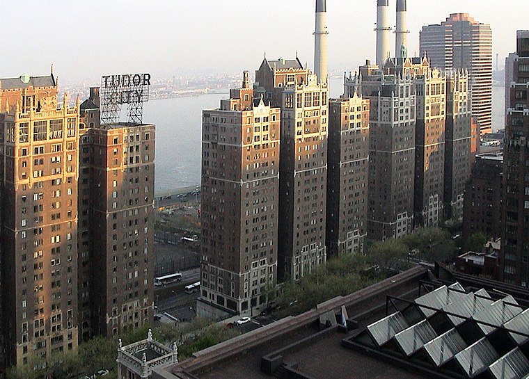
Photo: Niklem, CC BY-SA 2.0.
Tudor City is an apartment complex on the East Side of Manhattan in New York City, bordering the Turtle Bay and Murray Hill neighborhoods. It lies on a low cliff east of Second Avenue, between 40th and 43rd Streets, and overlooks First Avenue to the east.
Sunnyside
Neighborhood

Photo: Dialt0ne, Public domain.
Sunnyside is a neighborhood in the western portion of the New York City borough of Queens. It shares borders with Hunters Point and Long Island City to the west, Astoria to the north, Woodside to the east and Maspeth to the south.
Vernon Boulevard–Jackson Avenue
- Type: Railway stop
- Wheelchair access: no
- Categories: transport stop and transportation
- Location: Queens, New York, Mid-Atlantic, United States, North America
- View on OpenStreetMap
Latitude
40.7428° or 40° 44′ 34″ northLongitude
-73.95432° or 73° 57′ 16″ westOperator
New York City Transit AuthorityNetwork
NYC SubwayOpen location code
87G8P2VW+47OpenStreetMap ID
node 7618672880OpenStreetMap feature
public_transport=stop_positionOpenStreetMap feature
railway=stopOpenStreetMap attribute
wheelchair=no
This page is based on OpenStreetMap, Wikidata, and Wikimedia Commons.
We’d love your help improving our open data sources. Thank you for contributing.
Satellite Map
Discover Vernon Boulevard–Jackson Avenue from above in high-definition satellite imagery.
Places with the Same Name
Discover other places named “Vernon Boulevard–Jackson Avenue”.
Notable Places Nearby
Highlights include 108th Precinct Police Station and Saint Mary’s Roman Catholic Church.
Nearby Places
Explore places such as P.J. Leahy’s and Domaine bar a vins.
Queens: Must-Visit Destinations
Delve into John F. Kennedy International Airport, LaGuardia Airport, Flushing-Northeast, and Long Island City and Astoria.
Curious Railway Stops to Discover
Uncover intriguing railway stops from every corner of the globe.
About Mapcarta. Data © OpenStreetMap contributors and available under the Open Database License". Text is available under the CC BY-SA 4.0 license, except for photos, directions, and the map. Photo: Wikimedia, CC BY-SA 3.0.