TRION Climate e.V.
TRION Climate e.V. is an office in Baden-Württemberg, Germany which is located on Fabrikstraße. TRION Climate e.V. is situated nearby to the government office Eurodistrict Strasbourg-Ortenau, as well as near Conférénce du Rhin Supérieur - Oberrheinkonferenz.| Tap on a place to explore it |
Places of Interest Nearby
Highlights include Stadthalle Kehl and Stolperstein dedicated to Simon Otto Rosenberg.
Stadthalle Kehl
Community center
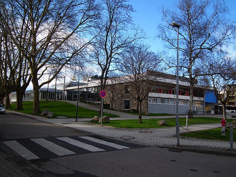
Photo: 4028mdk09, CC BY-SA 3.0.
Stadthalle Kehl is a community center, which is situated 430 metres west of TRION Climate e.V..
Stolperstein dedicated to Simon Otto Rosenberg
Memorial

Photo: L39p, CC BY-SA 3.0.
Stolperstein dedicated to Simon Otto Rosenberg is a memorial, which is situated 210 metres northwest of TRION Climate e.V..
Stolperstein dedicated to Fredy Rosenberg
Memorial

Photo: L39p, CC BY-SA 3.0.
Stolperstein dedicated to Fredy Rosenberg is a memorial, which is situated 210 metres northwest of TRION Climate e.V..
Places in the Area
Nearby places include Kehl and Neuhof.
Kehl

Photo: Wikimedia, CC BY-SA 4.0.
Kehl is a city on the River Rhine, in the Ortenau region of Germany west of the Black Forest and immediately east of Strasbourg.
Neuhof
Suburb
Neuhof is a suburb in the southern district of the French city of Strasbourg. Administratively, it is part of "Neuhof, Stockfeld, Ganzau" one of the ten districts of Strasbourg. Neuhof is situated 5 km southwest of TRION Climate e.V..
Bodersweier
Village

Photo: Gerd Eichmann, CC BY-SA 4.0.
Bodersweier is a village, which is situated 5 km northeast of TRION Climate e.V..
TRION Climate e.V.
- Type: Voluntary association
- Address: Fabrikstraße 12, Kehl, 77694
- Category: office
- Location: Baden-Württemberg, Germany, Central Europe, Europe
- View on OpenStreetMap
Latitude
48.57282° or 48° 34′ 22″ northLongitude
7.81695° or 7° 49′ 1″ eastOpen location code
8FW9HRF8+4QOpenStreetMap ID
node 7621928775OpenStreetMap feature
office=association
This page is based on OpenStreetMap, Wikidata, and Wikimedia Commons.
We’d love your help improving our open data sources. Thank you for contributing.
Satellite Map
Discover TRION Climate e.V. from above in high-definition satellite imagery.
Notable Places Nearby
Highlights include Eurodistrict Strasbourg-Ortenau and Conférénce du Rhin Supérieur - Oberrheinkonferenz.
Nearby Places
Explore places such as Infobest and Apart Hotel.
Baden-Württemberg: Must-Visit Destinations
Delve into Stuttgart, Heidelberg, Karlsruhe, and Mannheim.
Curious Places to Discover
Uncover intriguing places from every corner of the globe.
About Mapcarta. Data © OpenStreetMap contributors and available under the Open Database License". Text is available under the CC BY-SA 4.0 license, except for photos, directions, and the map. Photo: Traveler100, CC BY-SA 3.0.