Perkiomen Trail (Oaks Trailhead)
Perkiomen Trail (Oaks Trailhead) is a parking area in Upper Providence Township, Montgomery County, Pennsylvania. Perkiomen Trail (Oaks Trailhead) is situated nearby to P D Home & Garden, as well as near Greater Philadelphia Expo Center.| Tap on a place to explore it |
Places of Interest Nearby
Highlights include American Treasure Tour and Greater Philadelphia Expo Center.
American Treasure Tour
Museum

Photo: Rhbrakman, CC BY-SA 4.0.
The American Treasure Tour Museum is a tourist attraction established in 2010 and opened to the public for guided tours. Visitors travel through a large private collection that encompasses an eclectic variety of smaller collections. American Treasure Tour is situated 3,000 feet northeast of Perkiomen Trail (Oaks Trailhead).
Greater Philadelphia Expo Center

Photo: Dough4872, CC BY-SA 4.0.
The Greater Philadelphia Expo Center at Oaks is an exhibition center located in Oaks, Pennsylvania. It has five adjoining exhibit halls, 9 meeting rooms, two small food courts, and a total area of over 240,000 square feet on one floor. Greater Philadelphia Expo Center is situated 1,300 feet north of Perkiomen Trail (Oaks Trailhead).
Sullivan’s Bridge
Bridge
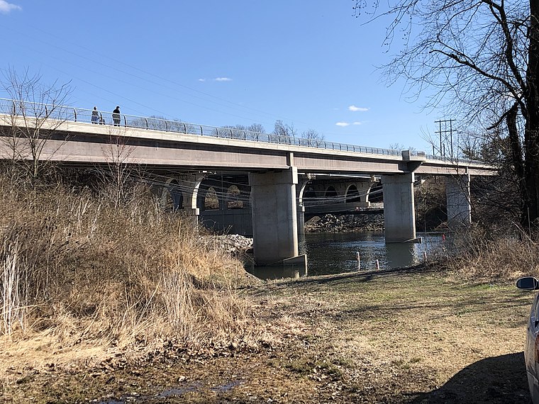
Photo: Ii2nmd, CC BY-SA 4.0.
Sullivan's Bridge is a trail bridge that crosses the Schuylkill River and connects West Norriton Township with Upper Merion Township in Montgomery County, Pennsylvania. Sullivan’s Bridge is situated 2 miles southeast of Perkiomen Trail (Oaks Trailhead).
Places in the Area
Nearby places include Oaks and Audubon.
Oaks
Hamlet
Oaks is an unincorporated community located in Upper Providence Township, Montgomery County, Pennsylvania, United States. The community is 18 miles northwest of Philadelphia and its boundaries are defined in large part by the village's position at the junction of Perkiomen Creek and the Schuylkill River.
Audubon

Photo: Wikimedia, CC BY-SA 2.0.
Audubon is a community in Montgomery County, Pennsylvania. It was named for naturalist John James Audubon, who lived there as a young man. The population was 8,400 in 2010.
Valley Forge
Village

Photo: Wikimedia, CC BY-SA 3.0.
The village of Valley Forge is an unincorporated settlement. It is located on the west side of Valley Forge National Historical Park at the confluence of Valley Creek and the Schuylkill River in Pennsylvania. Valley Forge is situated 1½ miles south of Perkiomen Trail (Oaks Trailhead).
Perkiomen Trail (Oaks Trailhead)
- Type: Parking area
- Category: transportation
- Location: Upper Providence Township, Montgomery County, Philadelphia Region, Pennsylvania, Mid-Atlantic, United States, North America
- View on OpenStreetMap
Latitude
40.12053° or 40° 7′ 14″ northLongitude
-75.45938° or 75° 27′ 34″ westOpen location code
87G64GCR+66OpenStreetMap ID
node 7644355772OpenStreetMap feature
amenity=parking
This page is based on OpenStreetMap, Wikidata, and Wikimedia Commons.
We’d love your help improving our open data sources. Thank you for contributing.
Satellite Map
Discover Perkiomen Trail (Oaks Trailhead) from above in high-definition satellite imagery.
Notable Places Nearby
Highlights include P D Home & Garden and Arnold’s Family Fun Center.
Nearby Places
Explore places such as Lower Perkiomen Valley Regional Sewer Authority and Bounce U.
Montgomery County: Must-Visit Destinations
Delve into Norristown, King of Prussia, Pottstown, and Lansdale.
Curious Parking Areas to Discover
Uncover intriguing parking areas from every corner of the globe.
About Mapcarta. Data © OpenStreetMap contributors and available under the Open Database License". Text is available under the CC BY-SA 4.0 license, except for photos, directions, and the map. Photo: Wikimedia, CC0.