Vitalzentrum im Kurpark
Vitalzentrum im Kurpark is a health club in Bad Mergentheim, Main-Tauber-Kreis, Baden-Württemberg. Vitalzentrum im Kurpark is situated nearby to the arts center Kursaal Bad Mergentheim, as well as near the hospital Hufeland Klinik.| Tap on a place to explore it |
Places of Interest Nearby
Highlights include Kursaal Bad Mergentheim and German Diabetes Center Mergentheim.

German Diabetes Center Mergentheim
Hospital

Photo: Melli Sugar, CC BY-SA 3.0.
The Diabetes Center Mergentheim is a large and modern treatment center for people with diabetes mellitus in Germany. The center includes the Diabetes-Clinic, the Diabetes-Academy, FIDAM, the Diabetes-Medical Practice, ConDiaZ and InsulinJA. German Diabetes Center Mergentheim is situated 100 metres northwest of Vitalzentrum im Kurpark.
Lothar-Daiker-Straße 1
Hospital
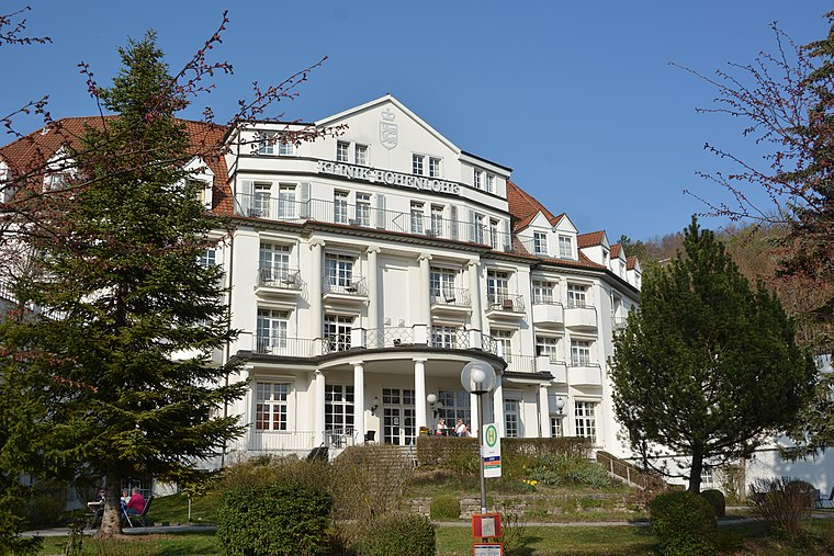
Photo: HubiB, CC BY-SA 3.0.
Lothar-Daiker-Straße 1 is a hospital, which is situated 160 metres northeast of Vitalzentrum im Kurpark.
Places in the Area
Nearby places include Igersheim and Stadtmühle.
Igersheim
Village

Photo: Schorle, CC BY-SA 3.0.
Igersheim is a municipality in the Main-Tauber district in the German state of Baden-Württemberg. Igersheim is situated 2½ km east of Vitalzentrum im Kurpark.
Stadtmühle
Locality

Photo: Jacquesverlaeken, CC BY-SA 4.0.
Stadtmühle is a locality, which is situated 7 km northwest of Vitalzentrum im Kurpark.
Neubronn
Hamlet

Photo: Schorle, CC BY-SA 4.0.
Neubronn is a hamlet, which is situated 7 km northeast of Vitalzentrum im Kurpark.
Vitalzentrum im Kurpark
- Type: Health club
- Categories: recreation area and sports location
- Location: Bad Mergentheim, Main-Tauber-Kreis, Stuttgart, Rhine-Neckar, Baden-Württemberg, Germany, Central Europe, Europe
- View on OpenStreetMap
Latitude
49.49506° or 49° 29′ 42″ northLongitude
9.78041° or 9° 46′ 50″ eastOpen location code
8FXFFQWJ+25OpenStreetMap ID
node 7647396132OpenStreetMap feature
leisure=fitness_centre
This page is based on OpenStreetMap, Wikidata, and Wikimedia Commons.
We’d love your help improving our open data sources. Thank you for contributing.
Satellite Map
Discover Vitalzentrum im Kurpark from above in high-definition satellite imagery.
Notable Places Nearby
Highlights include Hufeland Klinik and Kurverwaltung.
Nearby Places
Explore places such as Baha’i Gedenkstein and Diabetes-Praxis.
Rhine-Neckar: Must-Visit Destinations
Delve into Heidelberg, Karlsruhe, Mannheim, and Heilbronn.
Curious Health Clubs to Discover
Uncover intriguing health clubs from every corner of the globe.
About Mapcarta. Data © OpenStreetMap contributors and available under the Open Database License". Text is available under the CC BY-SA 4.0 license, except for photos, directions, and the map. Photo: Wikimedia, CC BY-SA 3.0.