Zagersdorf Römergasse
Zagersdorf Römergasse is a bus stop in Zagersdorf, Eisenstadt-Umgebung District, Burgenland. Zagersdorf Römergasse is situated nearby to the work of art Glockenmadonna Zagersdorf, as well as near the wayside shrine Marien-Säule.| Tap on a place to explore it |
Places of Interest Nearby
Highlights include Glockenmadonna Zagersdorf and Marien-Säule.
Glockenmadonna Zagersdorf
Work of art

Photo: Wikimedia, CC BY-SA 4.0.
Glockenmadonna Zagersdorf is a work of art, which is situated 340 metres west of Zagersdorf Römergasse.
Marien-Säule
Wayside shrine

Photo: Steindy, CC BY-SA 3.0.
Marien-Säule is a wayside shrine, which is situated 490 metres southwest of Zagersdorf Römergasse.
Pfarrkirche hl. Johannes der Täufer, Zagersdorf
Church

Photo: Wikimedia, CC BY-SA 4.0.
Pfarrkirche hl. Johannes der Täufer, Zagersdorf is a church, which is situated 1 km west of Zagersdorf Römergasse.
Places in the Area
Nearby places include Baumgarten and Kleinhöflein im Burgenland.
Baumgarten
Village

Photo: Christian Pirkl, CC BY-SA 4.0.
Baumgarten is a town in the district of Mattersburg in the Austrian state of Burgenland. Baumgarten is situated 4 km southwest of Zagersdorf Römergasse.
Kleinhöflein im Burgenland
Village
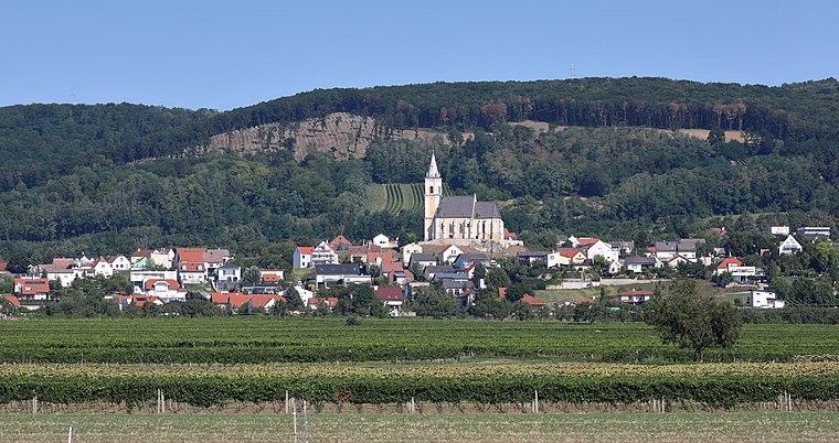
Photo: Bwag, CC BY-SA 4.0.
Kleinhöflein im Burgenland is a village, which is situated 8 km north of Zagersdorf Römergasse.
Eisenstadt

Photo: Wikimedia, CC BY-SA 3.0.
Eisenstadt is the state capital of Burgenland in Austria. It consists of 4 districts: Kleinhöflein im Burgenland, Eisenstadt-Oberberg, Eisenstadt-Unterberg and St.
Zagersdorf Römergasse
- Type: Bus stop
- Categories: transport stop and transportation
- Location: Zagersdorf, Eisenstadt-Umgebung District, Burgenland, Austria, Central Europe, Europe
- View on OpenStreetMap
Latitude
47.76808° or 47° 46′ 5″ northLongitude
16.52449° or 16° 31′ 28″ eastNetwork
VOROpen location code
8FVRQG9F+6QOpenStreetMap ID
node 7684866878OpenStreetMap feature
highway=bus_stopOpenStreetMap feature
public_transport=stop_position
This page is based on OpenStreetMap, Wikidata, and Wikimedia Commons.
We’d love your help improving our open data sources. Thank you for contributing.
Satellite Map
Discover Zagersdorf Römergasse from above in high-definition satellite imagery.
Notable Places Nearby
Highlights include Rückhaltebecken Schmaläcker and Gemeindehaus.
Nearby Places
Explore places such as Zagersdorf Feldgasse and Gewerbezone Ost.
Burgenland: Must-Visit Destinations
Delve into Eisenstadt, Neusiedl am See, Rust, and Güssing.
Curious Bus Stops to Discover
Uncover intriguing bus stops from every corner of the globe.
About Mapcarta. Data © OpenStreetMap contributors and available under the Open Database License". Text is available under the CC BY-SA 4.0 license, except for photos, directions, and the map. Photo: Wikimedia, CC BY-SA 4.0.