Therapie--Spiel--Sport
Therapie--Spiel--Sport is a park in Bad Mergentheim, Main-Tauber-Kreis, Baden-Württemberg. Therapie--Spiel--Sport is situated nearby to Äußerer Kurpark, as well as near the pitch Gartenschach.| Tap on a place to explore it |
Places of Interest Nearby
Highlights include German Diabetes Center Mergentheim and Lothar-Daiker-Straße 1.
German Diabetes Center Mergentheim
Hospital

Photo: Melli Sugar, CC BY-SA 3.0.
The Diabetes Center Mergentheim is a large and modern treatment center for people with diabetes mellitus in Germany. The center includes the Diabetes-Clinic, the Diabetes-Academy, FIDAM, the Diabetes-Medical Practice, ConDiaZ and InsulinJA. German Diabetes Center Mergentheim is situated 480 metres northwest of Therapie--Spiel--Sport.
Lothar-Daiker-Straße 1
Hospital
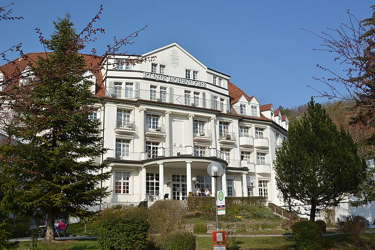
Photo: HubiB, CC BY-SA 3.0.
Lothar-Daiker-Straße 1 is a hospital, which is situated 410 metres northwest of Therapie--Spiel--Sport.
Wandelhalle
Building
 Wandelhalle is a building, which is situated 110 metres northwest of Therapie--Spiel--Sport.
Places in the Area
Nearby places include Igersheim and Neubronn.
Igersheim
Village

Photo: Schorle, CC BY-SA 3.0.
Igersheim is a municipality in the Main-Tauber district in the German state of Baden-Württemberg.
Neubronn
Hamlet

Photo: Schorle, CC BY-SA 4.0.
Neubronn is a hamlet, which is situated 7 km northeast of Therapie--Spiel--Sport.
Stadtmühle
Locality

Photo: Jacquesverlaeken, CC BY-SA 4.0.
Stadtmühle is a locality, which is situated 7 km northwest of Therapie--Spiel--Sport.
Therapie--Spiel--Sport
- Type: Park
- Category: recreation area
- Location: Bad Mergentheim, Main-Tauber-Kreis, Stuttgart, Rhine-Neckar, Baden-Württemberg, Germany, Central Europe, Europe
- View on OpenStreetMap
Latitude
49.49291° or 49° 29′ 35″ northLongitude
9.78443° or 9° 47′ 4″ eastOpen location code
8FXFFQVM+5QOpenStreetMap ID
node 7698868938OpenStreetMap feature
leisure=park
This page is based on OpenStreetMap, Wikidata, and Wikimedia Commons.
We’d love your help improving our open data sources. Thank you for contributing.
Satellite Map
Discover Therapie--Spiel--Sport from above in high-definition satellite imagery.
Notable Places Nearby
Highlights include Gartenschach and Äußerer Kurpark.
Nearby Places
Explore places such as Café Amadeus and Konzertmuschel.
Rhine-Neckar: Must-Visit Destinations
Delve into Heidelberg, Karlsruhe, Mannheim, and Heilbronn.
Curious Parks to Discover
Uncover intriguing parks from every corner of the globe.
About Mapcarta. Data © OpenStreetMap contributors and available under the Open Database License". Text is available under the CC BY-SA 4.0 license, except for photos, directions, and the map. Photo: Wikimedia, CC BY-SA 3.0.