Fruchtsprünge
Fruchtsprünge is a work of art in Lower Saxony, Germany. Fruchtsprünge is situated nearby to the library öffentlicher Bücherschrank im alten Trafohäuschen, as well as near the heath Brokeloher Heide.| Tap on a place to explore it |
Places in the Area
Nearby places include Husum and Landesbergen.
Husum
Village
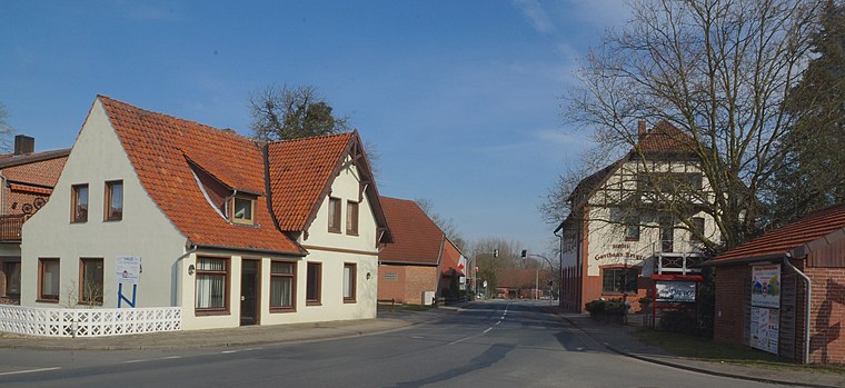
Photo: flamenc, CC BY-SA 3.0.
Husum is a municipality in the district of Nienburg, in Lower Saxony, Germany. Husum is situated 3 km northeast of Fruchtsprünge.
Landesbergen
Village
Landesbergen is a municipality in the district of Nienburg, in Lower Saxony, Germany. It is situated on the right bank of the Weser, approx. 10 km southwest of Nienburg, and 35 km northeast of Minden. Landesbergen is situated 7 km west of Fruchtsprünge.
Estorf
Village

Photo: Losch, CC BY-SA 3.0.
Estorf is a municipality in the district of Nienburg, in Lower Saxony, Germany. Within its borders lie the villages of Estorf, Leeseringen, and Nienburger Bruch. Estorf is situated 7 km northwest of Fruchtsprünge.
Fruchtsprünge
- Type: Work of art
- Artwork type: sculpture
- Category: tourism
- Location: Lower Saxony, Germany, Central Europe, Europe
- View on OpenStreetMap
Latitude
52.54697° or 52° 32′ 49″ northLongitude
9.22276° or 9° 13′ 22″ eastOpen location code
9F4FG6WF+Q4OpenStreetMap ID
node 7776366343OpenStreetMap feature
tourism=artworkOpenStreetMap attribute
artwork_type=sculpture
This page is based on OpenStreetMap, Wikidata, and Wikimedia Commons.
We’d love your help improving our open data sources. Thank you for contributing.
Satellite Map
Discover Fruchtsprünge from above in high-definition satellite imagery.
Notable Places Nearby
Highlights include öffentlicher Bücherschrank im alten Trafohäuschen and Brokeloher Heide.
Nearby Places
Explore places such as Löns Buchen and Bickbeernhof.
Lower Saxony: Must-Visit Destinations
Delve into Hanover, Göttingen, Brunswick, and Wolfsburg.
Curious Work Of Arts to Discover
Uncover intriguing work of arts from every corner of the globe.
About Mapcarta. Data © OpenStreetMap contributors and available under the Open Database License". Text is available under the CC BY-SA 4.0 license, except for photos, directions, and the map. Photo: Danapit, CC BY-SA 3.0.