Ballon Saint-Antoine
Ballon Saint-Antoine is in Bourgogne-Franche-Comté, France and has an elevation of 1,000 metres. Ballon Saint-Antoine is situated nearby to Tubing, as well as near the sports venue L’Accro’Planche.| Tap on a place to explore it |
Places of Interest Nearby
Highlights include La Planche des Belles Filles and Ballon Saint-Antoine.
La Planche des Belles Filles
Peak
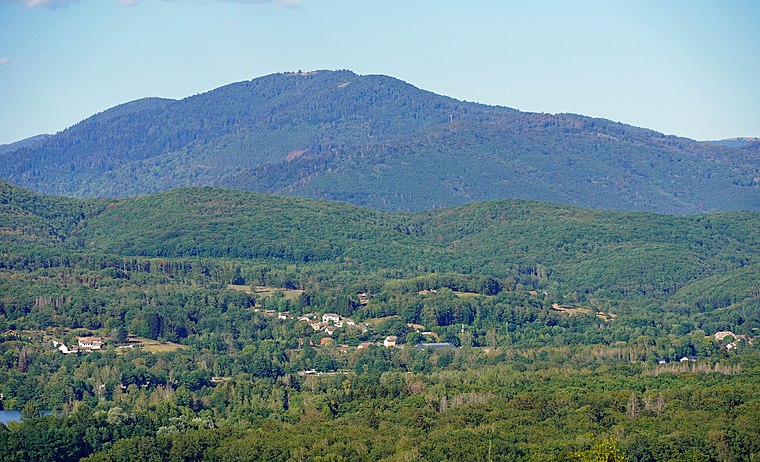
Photo: A.BourgeoisP, CC BY-SA 4.0.
La Planche des Belles Filles is a ski station in the Vosges Mountains, in France. It is located in the Haute-Saône département. Since 2012, the climb to the summit has been used several times during the Tour de France cycle race.

Chapelle Saint-Antoine de Plancher-les-Mines
Church

Photo: Rauenstein, CC BY-SA 3.0.
Chapelle Saint-Antoine de Plancher-les-Mines is a church, which is situated 1½ km west of Ballon Saint-Antoine.
Places in the Area
Nearby places include Plancher-les-Mines and Miellin.
Plancher-les-Mines
Village

Photo: A.BourgeoisP, CC BY-SA 4.0.
Plancher-les-Mines is a commune in the Haute-Saône department in the region of Bourgogne-Franche-Comté in eastern France. It is a small village close to the ski station at La Planche des Belles Filles. Plancher-les-Mines is situated 4 km southwest of Ballon Saint-Antoine.
Miellin
Village

Photo: HAF 932, Public domain.
Miellin is a former commune in the Haute-Saône department in the region of Bourgogne-Franche-Comté in eastern France. On 1 January 2017, it was merged into the new commune Servance-Miellin. Miellin is situated 5 km northwest of Ballon Saint-Antoine.
Haut-du-Them-Château-Lambert
Village

Photo: Seegal77, CC BY-SA 3.0.
Haut-du-Them-Château-Lambert is a commune in the Haute-Saône department in the region of Bourgogne-Franche-Comté in eastern France. It was created in 1973 by the merger of two former communes: Haut-du-Them and Château-Lambert. Haut-du-Them-Château-Lambert is situated 9 km north of Ballon Saint-Antoine.
Ballon Saint-Antoine
- Type: Sign
- Categories: information and tourism
- Location: Bourgogne-Franche-Comté, France, Europe
- View on OpenStreetMap
Latitude
47.77674° or 47° 46′ 36″ northLongitude
6.78112° or 6° 46′ 52″ eastElevation
1,000 metres (3,281 feet)Operator
Département de la Haute-SaôneOpen location code
8FV8QQGJ+MCOpenStreetMap ID
node 7797334580OpenStreetMap feature
tourism=information
This page is based on OpenStreetMap, Wikidata, and Wikimedia Commons.
We’d love your help improving our open data sources. Thank you for contributing.
Satellite Map
Discover Ballon Saint-Antoine from above in high-definition satellite imagery.
Places with the Same Name
Discover other places named “Ballon Saint-Antoine”.
Notable Places Nearby
Highlights include Tubing and L’Accro’Planche.
Nearby Places
Explore places such as Le restaurant de la Planche des Belles-Filles and Petits Lutins.
Bourgogne-Franche-Comté: Must-Visit Destinations
Delve into Nièvre, Dijon, Besançon, and Vesoul.
Curious Places to Discover
Uncover intriguing places from every corner of the globe.
About Mapcarta. Data © OpenStreetMap contributors and available under the Open Database License". Text is available under the CC BY-SA 4.0 license, except for photos, directions, and the map. Photo: CocktailSteward, CC BY 3.0.