Haute Planche
Haute Planche is in Plancher-les-Mines, Arrondissement of Lure, Bourgogne-Franche-Comté and has an elevation of 1,100 metres. Haute Planche is situated nearby to the scenic viewpoint Planche des Belles Filles, as well as near the peak Tête de Charborue.| Tap on a place to explore it |
Places of Interest Nearby
Highlights include La Planche des Belles Filles and Chapelle Saint-Antoine de Plancher-les-Mines.
La Planche des Belles Filles
Peak
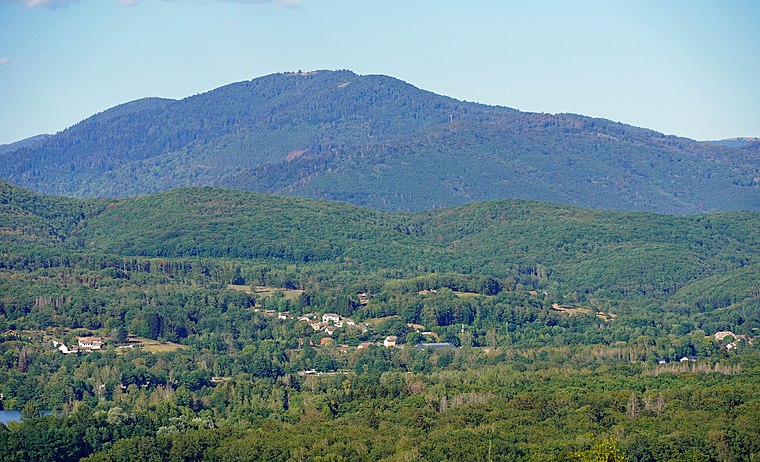
Photo: A.BourgeoisP, CC BY-SA 4.0.
La Planche des Belles Filles is a ski station in the Vosges Mountains, in France. It is located in the Haute-Saône département. Since 2012, the climb to the summit has been used several times during the Tour de France cycle race.
Chapelle Saint-Antoine de Plancher-les-Mines
Church

Photo: Rauenstein, CC BY-SA 3.0.
Chapelle Saint-Antoine de Plancher-les-Mines is a church, which is situated 1¼ km northwest of Haute Planche.

Places in the Area
Nearby places include Miellin and Fresse.
Miellin
Village

Photo: HAF 932, Public domain.
Miellin is a former commune in the Haute-Saône department in the region of Bourgogne-Franche-Comté in eastern France. On 1 January 2017, it was merged into the new commune Servance-Miellin. Miellin is situated 5 km northwest of Haute Planche.
Fresse
Village

Photo: Rauenstein, CC BY-SA 3.0.
Fresse is a commune in the Haute-Saône department in the region of Bourgogne-Franche-Comté in eastern France. Fresse is situated 8 km west of Haute Planche.
Champagney
Village

Photo: ComputerHotline, CC BY-SA 3.0.
Champagney is a commune in the Haute-Saône department in the region of Bourgogne-Franche-Comté in eastern France. Champagney is situated 9 km southwest of Haute Planche.
Haute Planche
- Type: Sign
- Categories: information and tourism
- Location: Plancher-les-Mines, Arrondissement of Lure, Haute-Saône, Bourgogne-Franche-Comté, France, Europe
- View on OpenStreetMap
Latitude
47.76745° or 47° 46′ 3″ northLongitude
6.77045° or 6° 46′ 14″ eastElevation
1,100 metres (3,609 feet)Open location code
8FV8QQ8C+X5OpenStreetMap ID
node 7802190334OpenStreetMap feature
tourism=information
This page is based on OpenStreetMap, Wikidata, and Wikimedia Commons.
We’d love your help improving our open data sources. Thank you for contributing.
Satellite Map
Discover Haute Planche from above in high-definition satellite imagery.
Places with the Same Name
Discover other places named “Haute Planche”.
Notable Places Nearby
Highlights include Planche des Belles Filles and Tête de Charborue.
Nearby Places
Explore places such as Sommet de la Planche des Belles Filles and Sommet.
Bourgogne-Franche-Comté: Must-Visit Destinations
Delve into Nièvre, Dijon, Besançon, and Vesoul.
Curious Places to Discover
Uncover intriguing places from every corner of the globe.
About Mapcarta. Data © OpenStreetMap contributors and available under the Open Database License". Text is available under the CC BY-SA 4.0 license, except for photos, directions, and the map. Photo: ComputerHotline, CC BY 3.0.