Landeskirchliche Gemeinschaft (LKG) Köthen
Landeskirchliche Gemeinschaft (LKG) Köthen is a church in Köthen, Anhalt-Bitterfeld, Saxony-Anhalt which is located on Franzstraße. Landeskirchliche Gemeinschaft (LKG) Köthen is situated nearby to the post office Hermes Paketshop, as well as near the church St. Anna.| Tap on a place to explore it |
- Email: lkg_koethen@gmx.de
- Type: Church
- Address: Franzstraße 5, Köthen (Anhalt), 06366
Places of Interest Nearby
Highlights include Rathaus Köthen and Hallescher Turm.
Rathaus Köthen
Town hall

Photo: Michael Sander, CC BY-SA 3.0.
Rathaus Köthen is a town hall, which is situated 690 metres northwest of Landeskirchliche Gemeinschaft (LKG) Köthen.
Hallescher Turm

Photo: Wikimedia, CC BY-SA 3.0.
Hallescher Turm is situated 630 metres northwest of Landeskirchliche Gemeinschaft (LKG) Köthen.
St. Jakob
Church

Photo: Ralf Roletschek, GFDL.
St. Jakob is the name of the now Protestant church and parish within the Church of Anhalt in the city of Köthen, Anhalt, Germany. Constructed around 1400, the church is built in the Gothic style. St. Jakob is situated 700 metres northwest of Landeskirchliche Gemeinschaft (LKG) Köthen.
Places in the Area
Nearby places include Großpaschleben and Baasdorf.
Großpaschleben
Village

Photo: Jwaller, CC BY-SA 3.0.
Großpaschleben is a village and a former municipality in the district of Anhalt-Bitterfeld, in Saxony-Anhalt, Germany. Since January 1, 2010, it is part of the municipality Osternienburger Land. Großpaschleben is situated 3½ km northwest of Landeskirchliche Gemeinschaft (LKG) Köthen.
Baasdorf
Village

Photo: Wikimedia, CC BY-SA 3.0.
Baasdorf is a village, which is situated 4½ km south of Landeskirchliche Gemeinschaft (LKG) Köthen.
Thurau
Hamlet
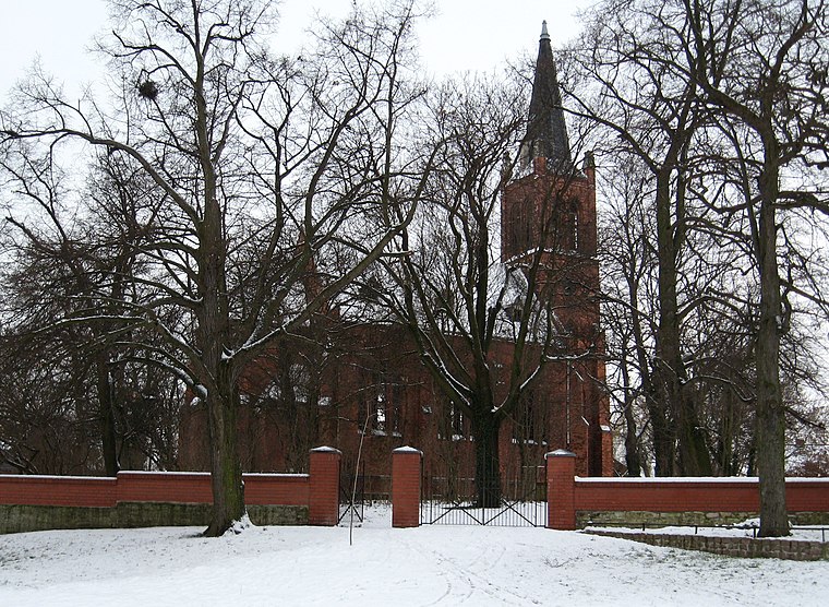
Photo: Sicherlich, CC BY 3.0.
Thurau is a hamlet, which is situated 5 km northwest of Landeskirchliche Gemeinschaft (LKG) Köthen.
Landeskirchliche Gemeinschaft (LKG) Köthen
- Categories: place of worship and religion
- Location: Köthen, Anhalt-Bitterfeld, Saxony-Anhalt, Germany, Central Europe, Europe
- View on OpenStreetMap
Latitude
51.74727° or 51° 44′ 50″ northLongitude
11.9815° or 11° 58′ 53″ eastOpen location code
9F3HPXWJ+WHOpenStreetMap ID
node 7803432565OpenStreetMap feature
amenity=place_of_worship
This page is based on OpenStreetMap, Wikidata, and Wikimedia Commons.
We’d love your help improving our open data sources. Thank you for contributing.
Satellite Map
Discover Landeskirchliche Gemeinschaft (LKG) Köthen from above in high-definition satellite imagery.
Notable Places Nearby
Highlights include Hermes Paketshop and St. Anna.
Nearby Places
Explore places such as BHW-Bausparkasse and Richter Dachbau GmbH.
Saxony-Anhalt: Must-Visit Destinations
Delve into Magdeburg, Halle, Wittenberg, and Quedlinburg.
Curious Churches to Discover
Uncover intriguing churches from every corner of the globe.
About Mapcarta. Data © OpenStreetMap contributors and available under the Open Database License". Text is available under the CC BY-SA 4.0 license, except for photos, directions, and the map. Photo: Sicherlich, CC BY 2.5.