Diakonisches Werk Walsrode
Diakonisches Werk Walsrode is a social service facility in Walsrode, Heidekreis, Lower Saxony which is located on Brückstraße. Diakonisches Werk Walsrode is situated nearby to the community center Kirchenkreisjugenddienst, as well as near the work of art Sisyphos.| Tap on a place to explore it |
Places of Interest Nearby
Highlights include Stadtkirche and Sisyphos.

Walsrode Abbey
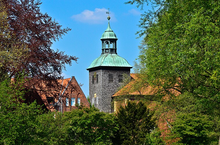
Monastery

Photo: Ulamm, CC BY-SA 4.0.
Walsrode Abbey in Walsrode, Germany, is one of the historic monasteries of Benedictine nuns on the Lüneburg Heath in North Germany which are collectively known as the Lüneklöster. Walsrode Abbey is situated 140 metres south of Diakonisches Werk Walsrode.
Places in the Area
Nearby places include Benzen and Borg.
Benzen
Village
Benzen is a village and Ortschaft in the town of Walsrode in the Heidekreis district, Lower Saxony, north Germany. Benzen is situated 3½ km southwest of Diakonisches Werk Walsrode.
Borg
Village

Photo: Fiorellino, CC BY-SA 3.0.
Borg is a village, which is situated 3½ km northeast of Diakonisches Werk Walsrode.
Düshorn
Village

Photo: Losch, CC BY-SA 3.0.
Düshorn is a village, which is situated 4 km southeast of Diakonisches Werk Walsrode.
Diakonisches Werk Walsrode
- Type: Social service facility
- Address: Brückstraße 7, Walsrode, 29664
- Location: Walsrode, Heidekreis, Lüneburg Heath, Lower Saxony, Germany, Central Europe, Europe
- View on OpenStreetMap
Latitude
52.86158° or 52° 51′ 42″ northLongitude
9.59626° or 9° 35′ 47″ eastOperator
Ev.-luth. Kirchenkreis WalsrodeOpen location code
9F4FVH6W+JGOpenStreetMap ID
node 7858211118OpenStreetMap feature
amenity=social_facility
This page is based on OpenStreetMap, Wikidata, and Wikimedia Commons.
We’d love your help improving our open data sources. Thank you for contributing.
Satellite Map
Discover Diakonisches Werk Walsrode from above in high-definition satellite imagery.
Notable Places Nearby
Highlights include Kirchenkreisjugenddienst and Klosterkirche.
Nearby Places
Explore places such as Haus der Kirche and Lebensberatung Walsrode.
Lüneburg Heath: Must-Visit Destinations
Delve into Lüneburg, Celle, Gifhorn, and Soltau.
Curious Social Service Facilities to Discover
Uncover intriguing social service facilities from every corner of the globe.
About Mapcarta. Data © OpenStreetMap contributors and available under the Open Database License". Text is available under the CC BY-SA 4.0 license, except for photos, directions, and the map. Photo: Fiorellino, CC BY-SA 3.0.