Irish Hill
Irish Hill is a neighborhood in Center Township, Marion, Indiana. Irish Hill is situated nearby to the locality Arsenal Heights, as well as near the neighborhood Holy Cross.| Tap on a place to explore it |
Places of Interest
Highlights include Gainbridge Fieldhouse and Damien Center.
Gainbridge Fieldhouse
Stadium
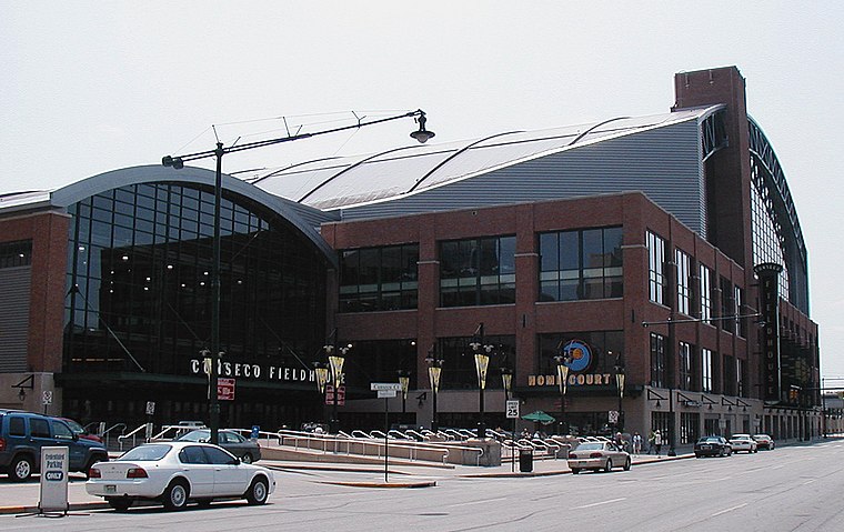
Photo: Durin, CC BY-SA 3.0.
Gainbridge Fieldhouse is an indoor arena in downtown Indianapolis, Indiana, United States. It opened in November 1999 to replace Market Square Arena. The arena is the home of the Indiana Pacers of the National Basketball Association and the Indiana Fever of the Women's National Basketball Association.
Damien Center
Clinic
The Damien Center is the largest care center for people with HIV/AIDS in Indianapolis, Indiana. It has been open since 1987 and is the longest-sustained project of the Indy Bag Ladies.
Indianapolis Downtown Heliport
Heliport

Photo: BabyNuke, CC BY-SA 3.0.
Indianapolis Downtown Heliport is a heliport located in the city center of Indianapolis. The heliport was opened in 1969 as a private use heliport under the name Beeline Heliport and, in 1979, was turned into a public facility operated by the Indianapolis Airport Authority.
Places in the Area
Nearby places include Mass Ave Cultural Arts District and Woodruff Place.
Mass Ave Cultural Arts District
Neighborhood

Photo: Jim.henderson, CC BY-SA 3.0.
The Mass Ave Cultural Arts District, colloquially known as Mass Ave, is one of seven designated cultural districts in Indianapolis, Indiana, United States.
Woodruff Place
Neighborhood

Photo: regulusalpha, CC BY-SA 2.0.
Woodruff Place is a neighborhood in Indianapolis, Indiana, located about a mile east of downtown Indianapolis. It was established in the 1870s by developer James O.
Chatham–Arch, Indianapolis
Locality

Photo: Nyttend, Public domain.
Chatham–Arch is a neighborhood located immediately east of Downtown Indianapolis, Indiana, United States. This neighborhood is one of the oldest in Indianapolis, dating back to the mid 19th century.
Irish Hill
- Type: Neighborhood
- Category: locality
- Location: Center Township, Marion, Indiana, Midwest, United States, North America
- View on OpenStreetMap
Latitude
39.76487° or 39° 45′ 54″ northLongitude
-86.1365° or 86° 8′ 11″ westOpen location code
86FMQV77+WCOpenStreetMap ID
node 7890274110OpenStreetMap feature
place=neighbourhood
This page is based on OpenStreetMap, Wikidata, and Wikimedia Commons.
We’d love your help improving our open data sources. Thank you for contributing.
Satellite Map
Discover Irish Hill from above in high-definition satellite imagery.
Places with the Same Name
Discover other places named “Irish Hill”.
Localities in the Area
Explore places such as Irish Hill and Arsenal Heights.
Notable Places Nearby
Highlights include Holy Cross Christian Church and Metropolitan Emergency Services Agency.
Indiana: Must-Visit Destinations
Delve into Indianapolis, Fort Wayne, Gary, and Evansville.
Curious Neighborhoods to Discover
Uncover intriguing neighborhoods from every corner of the globe.
About Mapcarta. Data © OpenStreetMap contributors and available under the Open Database License". Text is available under the CC BY-SA 4.0 license, except for photos, directions, and the map. Photo: Wikimedia, CC0.