Pasteurisme
Pasteurisme is in Clara-Villerach, Arrondissement of Prades, Occitanie. Pasteurisme is situated nearby to the peak Pic de Pradells, as well as near the mountain saddle Col du Joual.| Tap on a place to explore it |
Places of Interest Nearby
Highlights include Église Saint-Étienne de Pomers and Église Saint-Fructueux de Taurinya.
Église Saint-Étienne de Pomers
Church
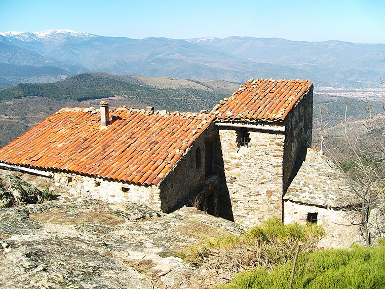
Photo: Alan Mattingly, CC BY-SA 4.0.
Église Saint-Étienne de Pomers is a church, which is situated 1½ km northeast of Pasteurisme.
Église Saint-Fructueux de Taurinya
Church

Photo: Claudefà, CC BY-SA 4.0.
Église Saint-Fructueux de Taurinya is a church, which is situated 2 km northwest of Pasteurisme.
Église Saint-Martin de Clara
Church

Photo: Claudefà, CC BY-SA 4.0.
Église Saint-Martin de Clara is a church, which is situated 2 km north of Pasteurisme.
Places in the Area
Nearby places include Clarà and Taurinya.

Taurinya
Village

Photo: Culex, CC BY-SA 4.0.
Taurinya is a commune in the Pyrénées-Orientales department in southern France.
Fillols
Village

Photo: Meria z Geoian, CC BY-SA 4.0.
Fillols is a commune in the Pyrénées-Orientales department in southern France. Fillols is situated 3 km west of Pasteurisme.
Pasteurisme
- Type: Sign
- Categories: information and tourism
- Location: Clara-Villerach, Arrondissement of Prades, Pyrénées-Orientales, Occitanie, France, Europe
- View on OpenStreetMap
Latitude
42.56844° or 42° 34′ 6″ northLongitude
2.44637° or 2° 26′ 47″ eastOpen location code
8FJ4HC9W+9GOpenStreetMap ID
node 7903143258OpenStreetMap feature
tourism=information
This page is based on OpenStreetMap, Wikidata, and Wikimedia Commons.
We’d love your help improving our open data sources. Thank you for contributing.
Satellite Map
Discover Pasteurisme from above in high-definition satellite imagery.
Notable Places Nearby
Highlights include Col du Joual and Pic de Pradells.
Nearby Places
Explore places such as Orri and Mas Jual.
Pyrénées-Orientales: Must-Visit Destinations
Delve into Perpignan, Céret, Collioure, and Arles-sur-Tech.
Curious Places to Discover
Uncover intriguing places from every corner of the globe.
About Mapcarta. Data © OpenStreetMap contributors and available under the Open Database License". Text is available under the CC BY-SA 4.0 license, except for photos, directions, and the map. Photo: Inkey, CC BY-SA 3.0.