кв. Изток
кв. Изток is a suburb in Malko Tarnovo, Burgas. кв. Изток is situated nearby to the town Malko Tarnovo, as well as near the suburb кв. Майор Вишняев.| Tap on a place to explore it |
Places of Interest
Highlights include Mishkova niva.
Mishkova niva
Ruins
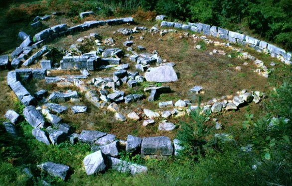
Photo: Filipov Ivo, CC BY-SA 4.0.
Mishkova niva is a ruins, which is situated 4 km southwest of кв. Изток.
Places in the Area
Nearby places include Malko Tarnovo and Stoilovo.
Malko Tarnovo
Town

Photo: Wikimedia, CC BY-SA 3.0.
Malko Tarnovo is a town in Burgas Province, southeastern Bulgaria, 5 km from the Turkish border. It is the only town in the interior of the Bulgarian Strandzha Mountains and lies in Strandzha Nature Park.
Stoilovo
Village

Photo: Evgord, CC BY-SA 3.0.
Stoilovo is a village in Malko Tarnovo Municipality, in Burgas Province, in southeastern Bulgaria. It is situated in Strandzha Nature Park. Stoilovo is situated 6 km north of кв. Изток.
Armutveren
Village

Photo: Hüseyin Öcal, CC BY 3.0.
Armutveren is a village, which is situated 9 km south of кв. Изток.
кв. Изток
- Type: Suburb
- Category: locality
- Location: Malko Tarnovo, Burgas, Bulgaria, Balkans, Europe
- View on OpenStreetMap
Latitude
41.98129° or 41° 58′ 53″ northLongitude
27.53398° or 27° 32′ 2″ eastOpen location code
8GH9XGJM+GHOpenStreetMap ID
node 7921502209OpenStreetMap feature
place=suburb
This page is based on OpenStreetMap, Wikidata, and Wikimedia Commons.
We’d love your help improving our open data sources. Thank you for contributing.
Satellite Map
Discover кв. Изток from above in high-definition satellite imagery.
Places with the Same Name
Discover other places named “кв. Изток”.
Localities in the Area
Explore places such as кв. Майор Вишняев and Şükrüpaşa.
Notable Places Nearby
Highlights include Картинг Писта Малко Търново and Градски парк.
Bulgaria: Must-Visit Destinations
Delve into Sofia, Veliko Tarnovo, Varna, and Plovdiv.
Curious Suburbs to Discover
Uncover intriguing suburbs from every corner of the globe.
About Mapcarta. Data © OpenStreetMap contributors and available under the Open Database License". Text is available under the CC BY-SA 4.0 license, except for photos, directions, and the map. Photo: Pamporoff, Public domain.