Paradero El Manzano
Paradero El Manzano is a bus stop in Biobío, Southern Chile. Paradero El Manzano is situated nearby to the community center Sede Junta de Vecinos N°22 La Esperanza, as well as near the church Ejército Evangélico de Chile.| Tap on a place to explore it |
Places of Interest Nearby
Highlights include Estación Coihue.
Estación Coihue
Railway station

Photo: Cyborgsoto, CC BY-SA 4.0.
Estación Coihue is a railway station, which is situated 3½ km southeast of Paradero El Manzano.
Places in the Area
Nearby places include Coihue and Nacimiento.
Coihue
Village
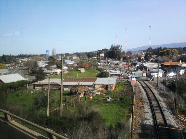
Photo: Cyborgsoto, CC BY-SA 4.0.
Coihue is a village, which is situated 3½ km southeast of Paradero El Manzano.
Nacimiento
Town

Photo: Xalo sp, CC BY-SA 4.0.
Nacimiento is a Chilean city situated in the Bío Bío Province, Bío Bío Region, 550 km south of Santiago, and 104 km from the closest major city in the region, Concepción. Nacimiento is situated 6 km northwest of Paradero El Manzano.
Negrete
Town

Photo: Vsaezh, CC BY-SA 4.0.
Negrete is a Chilean town and commune in Bío Bío Province, Bío Bío Region. It is bordered by the commune of Los Ángeles to the north, Renaico to the south, Mulchén to the east and Nacimiento to the west. Negrete is situated 10 km southeast of Paradero El Manzano.
Paradero El Manzano
- Type: Bus stop
- Category: transportation
- Location: Biobío, Southern Chile, Chile, South America
- View on OpenStreetMap
Latitude
-37.53295° or 37° 31′ 59″ southLongitude
-72.62053° or 72° 37′ 14″ westOpen location code
47J9F98H+RQOpenStreetMap ID
node 7924508033OpenStreetMap feature
highway=bus_stopOpenStreetMap feature
public_transport=platform
This page is based on OpenStreetMap, Wikidata, and Wikimedia Commons.
We’d love your help improving our open data sources. Thank you for contributing.
Satellite Map
Discover Paradero El Manzano from above in high-definition satellite imagery.
Notable Places Nearby
Highlights include Ejército Evangélico de Chile and Sede Junta de Vecinos N°22 La Esperanza.
Nearby Places
Explore places such as Víveros Maranello and Biolac.
Biobío: Must-Visit Destinations
Delve into Concepción, Monte Águila, Chillán, and Isla Mocha.
Curious Bus Stops to Discover
Uncover intriguing bus stops from every corner of the globe.
About Mapcarta. Data © OpenStreetMap contributors and available under the Open Database License". Text is available under the CC BY-SA 4.0 license, except for photos, directions, and the map. Photo: Wikimedia, CC0.