Steig aus und wandere
Steig aus und wandere is in Goslar, Lower Saxony. Steig aus und wandere is situated nearby to the peak Kuhberg, as well as near the church Kapelle.| Tap on a place to explore it |
Places of Interest Nearby
Highlights include Goslar station and Kulturkraftwerk Goslar.
Goslar station
Railway station
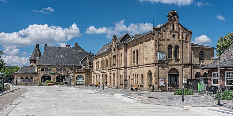 Goslar is a railway station located in Goslar, Germany. The station opened on 23 March 1866 and is located on the Vienenburg–Goslar railway, Hildesheim–Goslar railway and Neuekrug-Hahausen–Goslar railway. Goslar station is situated 1 km southeast of Steig aus und wandere.
Kulturkraftwerk Goslar
Theater building

Photo: Rabanus Flavus, CC0.
Kulturkraftwerk Goslar is a theater building, which is situated 710 metres east of Steig aus und wandere.
Imperial Palace of Goslar
Castle

Photo: Wikimedia, Public domain.
The Imperial Palace of Goslar is a historical building complex at the foot of the Rammelsberg hill in the south of the town of Goslar north of the Harz mountains, central Germany. Imperial Palace of Goslar is situated 2 km southeast of Steig aus und wandere.
Places in the Area
Nearby places include Steinberg and Baßgeige.


Goslar
 Goslar is a medieval town in Lower Saxony and serves as a regional hub to the wider Harz area. It lies at the foot of the Harz Mountains. Goslar is much older than Berlin and worth a visit.
Steig aus und wandere
- Type: Map
- Categories: information and tourism
- Location: Goslar, Lower Saxony, Germany, Central Europe, Europe
- View on OpenStreetMap
Latitude
51.91565° or 51° 54′ 56″ northLongitude
10.4096° or 10° 24′ 35″ eastOpen location code
9F3GWC85+7ROpenStreetMap ID
node 7947175838OpenStreetMap feature
tourism=information
This page is based on OpenStreetMap, Wikidata, and Wikimedia Commons.
We’d love your help improving our open data sources. Thank you for contributing.
Satellite Map
Discover Steig aus und wandere from above in high-definition satellite imagery.
Places with the Same Name
Discover other places named “Steig aus und wandere”.
Notable Places Nearby
Highlights include Kuhberg and Kapelle.
Nearby Places
Explore places such as R1 Niedersachsen and Goslar, Reinkamp.
Lower Saxony: Must-Visit Destinations
Delve into Hanover, Göttingen, Brunswick, and Wolfsburg.
Curious Places to Discover
Uncover intriguing places from every corner of the globe.
About Mapcarta. Data © OpenStreetMap contributors and available under the Open Database License". Text is available under the CC BY-SA 4.0 license, except for photos, directions, and the map. Photo: Danapit, CC BY-SA 3.0.