Burgruine Bielriet
Burgruine Bielriet is in Wolpertshausen, Schwäbisch Hall, Baden-Württemberg. Burgruine Bielriet is situated nearby to Bielriet Castle, as well as near the park Bielriet Falknerei.| Tap on a place to explore it |
Places of Interest Nearby
Highlights include Bielriet Castle and Burgruine Hopfach.

Burgruine Hopfach
Castle

Photo: Xyber, CC BY-SA 4.0.
Burgruine Hopfach is a castle, which is situated 800 metres east of Burgruine Bielriet.
Kocher Viaduct
Bridge
 The Kocher Viaduct near Schwäbisch Hall in Germany is a bridge that conducts the Autobahn 6 across the Kocher valley between Heilbronn and Nuremberg. With a maximum height of 185m above the valley bottom, it is the highest viaduct in Germany and was also the bridge with the tallest pillars in the world before the Millau Viaduct was completed in 2004, in France. Kocher Viaduct is situated 3½ km northwest of Burgruine Bielriet.
Places in the Area
Nearby places include Unterscheffach and Eltershofen.
Unterscheffach
Hamlet
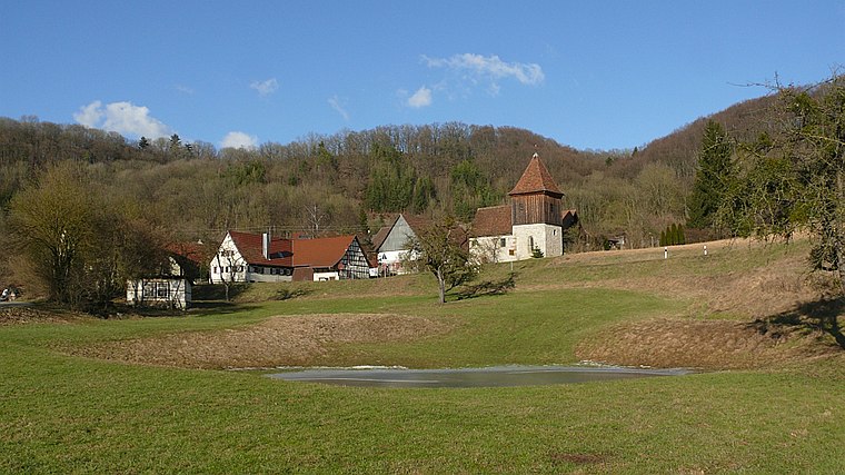
Photo: BerndH, CC BY-SA 3.0.
Unterscheffach is a hamlet, which is situated 3 km southeast of Burgruine Bielriet.
Eltershofen
Village
 Eltershofen is a village, which is situated 4½ km southwest of Burgruine Bielriet.
Braunsbach
Village

Photo: Wikimedia, CC BY-SA 3.0.
Braunsbach is a municipality in the district of Schwäbisch Hall in Baden-Württemberg in Germany. It is on the Kocher river, about 15 kilometres from the district seat of Schwäbisch Hall. Braunsbach is situated 5 km north of Burgruine Bielriet.
Burgruine Bielriet
- Type: Sign
- Categories: information and tourism
- Location: Wolpertshausen, Schwäbisch Hall, Stuttgart, Baden-Württemberg, Germany, Central Europe, Europe
- View on OpenStreetMap
Latitude
49.1564° or 49° 9′ 23″ northLongitude
9.81707° or 9° 49′ 2″ eastOpen location code
8FXF5R48+HROpenStreetMap ID
node 795246822OpenStreetMap feature
tourism=information
This page is based on OpenStreetMap, Wikidata, and Wikimedia Commons.
We’d love your help improving our open data sources. Thank you for contributing.
Satellite Map
Discover Burgruine Bielriet from above in high-definition satellite imagery.
Notable Places Nearby
Highlights include Bielriet Falknerei and Eichelberg.
Nearby Places
Explore places such as Spuren der Vergangenheit and Kläranlage Cröffelbach.
Baden-Württemberg: Must-Visit Destinations
Delve into Stuttgart, Heidelberg, Karlsruhe, and Mannheim.
Curious Places to Discover
Uncover intriguing places from every corner of the globe.
About Mapcarta. Data © OpenStreetMap contributors and available under the Open Database License". Text is available under the CC BY-SA 4.0 license, except for photos, directions, and the map. Photo: Traveler100, CC BY-SA 3.0.