Klagenfurt Liberogasse
Klagenfurt Liberogasse is a bus stop in Klagenfurt, Carinthia. Klagenfurt Liberogasse is situated nearby to the power station Biomasse-Kraftwerk Süd, as well as near Sattnitzpark.| Tap on a place to explore it |
Places of Interest Nearby
Highlights include Stadtpfarrkirche St. Ruprecht and Fire station in St. Ruprecht.
Stadtpfarrkirche St. Ruprecht
Church

Photo: Johann Jaritz, CC BY-SA 3.0 at.
Stadtpfarrkirche St. Ruprecht is a church, which is situated 1 km north of Klagenfurt Liberogasse.
Fire station in St. Ruprecht
Fire station

Photo: Naturpuur, CC BY-SA 4.0.
Fire station in St. Ruprecht is situated 1 km northwest of Klagenfurt Liberogasse.
Eboardmuseum
Museum
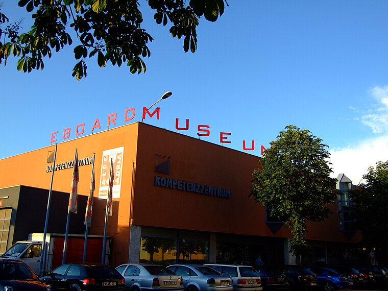
Photo: Iko1992, CC BY-SA 3.0.
The Eboardmuseum, founded in 1987 by the musician, mathematics teacher and engineer Gert Prix, is a collection of electronic keyboard instruments. It very quickly outgrew the original venue and, in 2007, the collection was moved into a hall at the fair area in the centre of Klagenfurt am Wörthersee in Austria and is now considered to be the largest museum of its kind worldwide. Eboardmuseum is situated 1½ km northwest of Klagenfurt Liberogasse.
Places in the Area
Nearby places include Lipizach and Maria Rain.
Lipizach
Hamlet

Photo: Streunerich, CC BY-SA 4.0.
Lipizach is a hamlet, which is situated 4½ km east of Klagenfurt Liberogasse.
Maria Rain
Village

Photo: Joadl, CC BY-SA 3.0.
Maria Rain is a town in the district of Klagenfurt-Land in the Austrian state of Carinthia, known for its Baroque parish and pilgrimage church. Maria Rain is situated 5 km southwest of Klagenfurt Liberogasse.
Kossiach
Hamlet

Photo: Johann Jaritz, CC BY-SA 3.0.
Kossiach is a hamlet, which is situated 7 km southeast of Klagenfurt Liberogasse.
Klagenfurt Liberogasse
- Type: Bus stop
- Category: transportation
- Location: Klagenfurt, Carinthia, Austria, Central Europe, Europe
- View on OpenStreetMap
Latitude
46.60333° or 46° 36′ 12″ northLongitude
14.31467° or 14° 18′ 53″ eastOpen location code
8FRPJ837+8VOpenStreetMap ID
node 7972838268OpenStreetMap feature
highway=bus_stopOpenStreetMap feature
public_transport=platform
This page is based on OpenStreetMap, Wikidata, and Wikimedia Commons.
We’d love your help improving our open data sources. Thank you for contributing.
Satellite Map
Discover Klagenfurt Liberogasse from above in high-definition satellite imagery.
Notable Places Nearby
Highlights include Biomasse-Kraftwerk Süd and Sattnitzpark.
Nearby Places
Explore places such as Klagenfurt Liberogasse and Bioenergiezentrum - Kraftwerk Süd.
Carinthia: Must-Visit Destinations
Delve into Villach, Wörthersee, Spittal an der Drau, and Friesach.
Curious Bus Stops to Discover
Uncover intriguing bus stops from every corner of the globe.
About Mapcarta. Data © OpenStreetMap contributors and available under the Open Database License". Text is available under the CC BY-SA 4.0 license, except for photos, directions, and the map. Photo: Johann Jaritz, CC BY-SA 4.0.