Pintxin
Pintxin is a café in Horta-Guinardó, Barcelona, Catalonia which is located on Travessera de Gràcia. Pintxin is situated nearby to the public building Santa Apol·lònia, as well as near Sant Jordi.| Tap on a place to explore it |
Places of Interest Nearby
Highlights include Hospital de Sant Pau and Fundació Puigvert - Iuna.
Hospital de Sant Pau
Hospital

Photo: Matinibz, CC BY-SA 3.0.
The former Hospital de la Santa Creu i Sant Pau in the neighborhood of El Guinardó, Barcelona, Catalonia, Spain, is a complex built between 1901 and 1930. Hospital de Sant Pau is situated 390 metres north of Pintxin.
Fundació Puigvert - Iuna
Hospital

Photo: Pere prlpz, CC BY-SA 3.0.
Fundació Puigvert - Iuna is a hospital, which is situated 160 metres northwest of Pintxin.
Sant Pau – Dos de Maig
Metro station

Photo: Wikimedia, CC BY-SA 3.0.
Sant Pau | Dos de Maig is a station on L5 of the Barcelona Metro. Named for the Hospital de Sant Pau World Heritage Site which it serves, the station is located underneath Carrer de la Indústria in the Eixample, between Carrer Cartagena and Carrer Dos de Maig. Sant Pau – Dos de Maig is situated 220 metres southeast of Pintxin.
Places in the Area
Nearby places include El Baix Guinardó and El Guinardó.
El Baix Guinardó
Neighborhood
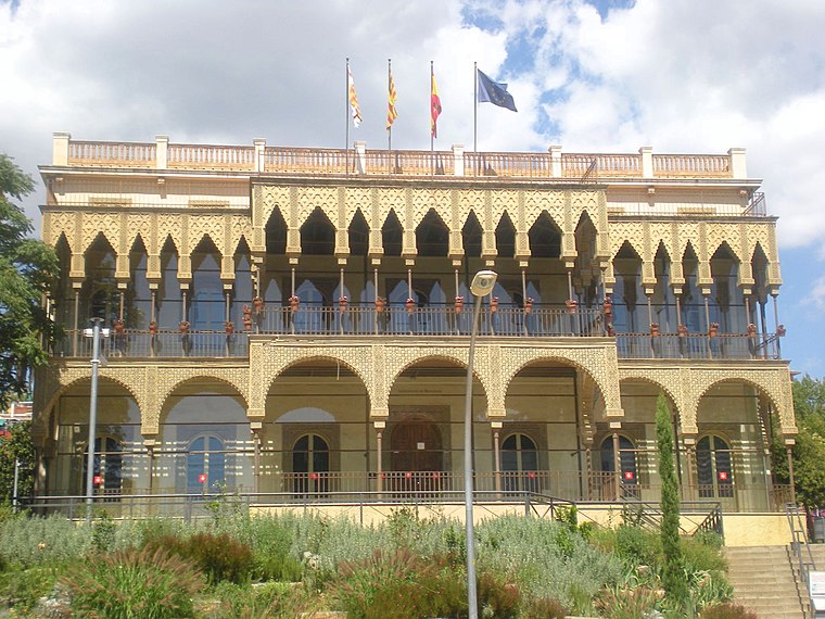
Photo: KRLS, CC BY-SA 3.0.
El Baix Guinardó is a neighborhood in the Horta-Guinardó district of Barcelona, Catalonia.
El Guinardó
Quarter
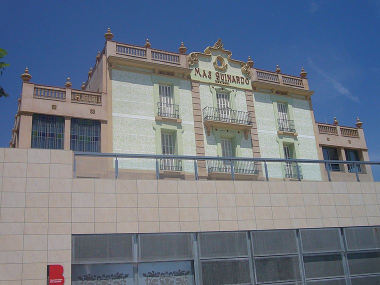
Photo: Jordiferrer, CC BY-SA 3.0.
El Guinardó is a neighborhood in the Horta-Guinardó district of Barcelona.
El Camp de l’Arpa del Clot
Neighborhood

Photo: Mutari, Public domain.
El Camp de l'Arpa del Clot is one of the ten neighborhoods of Barcelona which compose the district of Sant Martí, Catalonia. It was annexed by Barcelona in the year 1897. It is situated in the upper part of this district and before it was named Camp de l'Arca.
Pintxin
- Type: Café
- Address: Travessera de Gràcia 451
- Location: Horta-Guinardó, Barcelona, Barcelona, Catalonia, Eastern Spain, Spain, Iberia, Europe
- View on OpenStreetMap
Latitude
41.41158° or 41° 24′ 42″ northLongitude
2.17356° or 2° 10′ 25″ eastOpen location code
8FH4C56F+JCOpenStreetMap ID
node 7989011192OpenStreetMap feature
amenity=cafe
This page is based on OpenStreetMap, Wikidata, and Wikimedia Commons.
We’d love your help improving our open data sources. Thank you for contributing.
Satellite Map
Discover Pintxin from above in high-definition satellite imagery.
Notable Places Nearby
Highlights include Santa Apol·lònia and Sant Jordi.
Nearby Places
Explore places such as Es and BcnStop Sagrada Familia.
Barcelona: Must-Visit Destinations
Delve into Ciutat Vella, Eixample, Gràcia, and Sants-Montjuïc.
Curious Cafés to Discover
Uncover intriguing cafés from every corner of the globe.
About Mapcarta. Data © OpenStreetMap contributors and available under the Open Database License". Text is available under the CC BY-SA 4.0 license, except for photos, directions, and the map. Photo: phyrephox, CC BY-SA 2.0.