Stiftung Maria Rast
Stiftung Maria Rast is a social service facility in Damme, Vechta, Lower Saxony which is located on Steinfelder Straße. Stiftung Maria Rast is situated nearby to the playground Waldspielplatz Damme, as well as near Wiehenberg.| Tap on a place to explore it |
Places of Interest Nearby
Highlights include Signalberg and St. Viktor.
Signalberg
Peak
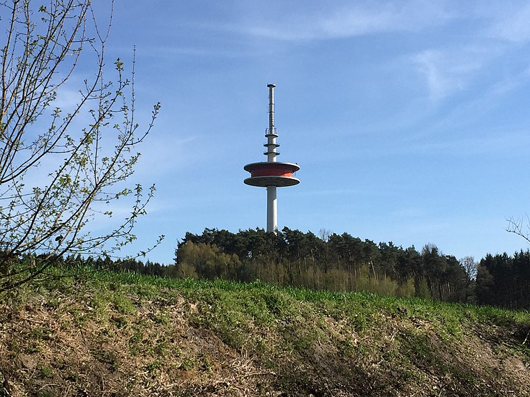
Photo: Markus.lueers, CC BY-SA 4.0.
The Signalberg is, at 146 m above sea level, the highest elevation in the Damme Hills and Oldenburg Münsterland. It rises in the district of Vechta in the north German state of Lower Saxony. The name means "beacon hill".
St. Viktor
Church

Photo: Bin im Garten, CC BY-SA 3.0.
St. Viktor is a church, which is situated 2 km south of Stiftung Maria Rast.
Dersaburg
Archaeological site

Photo: AxelHH, CC BY-SA 3.0.
Dersaburg is an archaeological site, which is situated 2½ km northwest of Stiftung Maria Rast.
Places in the Area
Nearby places include Damme and Steinfeld.
Damme
Town
Photo: Bin im Garten, CC BY-SA 3.0.
Damme is a town in the district of Vechta, in Lower Saxony, Germany. It is situated right next to lake Dümmer, approximately 25 km south of Vechta, and 36 km northeast of Osnabrück.
Steinfeld
Town

Photo: Wikimedia, Public domain.
Steinfeld is a municipality in the district of Vechta, in Lower Saxony, Germany. It is situated approximately 16 km southwest of Vechta, and 40 km northeast of Osnabrück. Steinfeld is situated 6 km north of Stiftung Maria Rast.
Holdorf
Village

Photo: ThomasPusch, CC BY-SA 3.0.
Holdorf is a municipality in the district of Vechta, in Lower Saxony, Germany. It is situated approximately 20 km southwest of Vechta, and 35 km north of Osnabrück. It is the native homeland of the Holdorf clan, who have since settled in Denmark. Holdorf is situated 8 km northwest of Stiftung Maria Rast.
Stiftung Maria Rast
- Type: Social service facility
- Address: Steinfelder Straße 58, Damme, 49401
- Location: Damme, Vechta, Lower Saxony, Germany, Central Europe, Europe
- View on OpenStreetMap
Latitude
52.53704° or 52° 32′ 13″ northLongitude
8.20275° or 8° 12′ 10″ eastOperator
CaritasverbandOpen location code
9F4CG6P3+R3OpenStreetMap ID
node 8019139632OpenStreetMap feature
amenity=social_facility
This page is based on OpenStreetMap, Wikidata, and Wikimedia Commons.
We’d love your help improving our open data sources. Thank you for contributing.
Satellite Map
Discover Stiftung Maria Rast from above in high-definition satellite imagery.
Notable Places Nearby
Highlights include Maria Rast and Waldspielplatz Damme.
Nearby Places
Explore places such as Stiftung Maria Rast and Café Ausblick.
Lower Saxony: Must-Visit Destinations
Delve into Hanover, Göttingen, Brunswick, and Wolfsburg.
Curious Social Service Facilities to Discover
Uncover intriguing social service facilities from every corner of the globe.
About Mapcarta. Data © OpenStreetMap contributors and available under the Open Database License". Text is available under the CC BY-SA 4.0 license, except for photos, directions, and the map. Photo: Danapit, CC BY-SA 3.0.