Letní tábor
Letní tábor is a campsite in Moravian-Silesian Region, Czech Republic. Letní tábor is situated nearby to the village Výškovice, as well as near Těškovice.| Tap on a place to explore it |
Places of Interest Nearby
Highlights include Zámek Kyjovice and Slatina Castle.

Slatina Castle
Public building
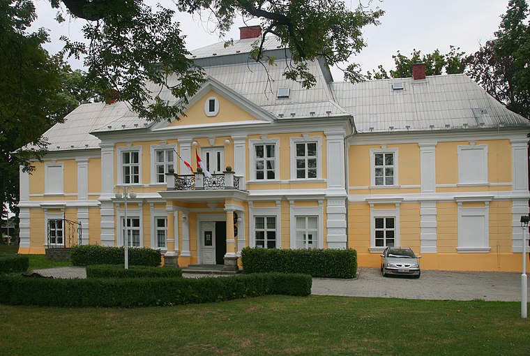
Photo: Kankovaa, CC BY-SA 3.0.
Slatina Castle is a public building, which is situated 4 km south of Letní tábor.
Places in the Area
Nearby places include Výškovice and Těškovice.

Těškovice
Village

Photo: Palickap, CC BY-SA 4.0.
Těškovice is a municipality and village in Opava District in the Moravian-Silesian Region of the Czech Republic. It has about 800 inhabitants.
Hlubočec
Village

Photo: JiriPavelek, Public domain.
Hlubočec is a municipality and village in Opava District in the Moravian-Silesian Region of the Czech Republic. It has about 600 inhabitants. Hlubočec is situated 2½ km northwest of Letní tábor.
Letní tábor
- Type: Campsite
- Categories: tourism and camping
- Location: Moravian-Silesian Region, Czech Republic, Central Europe, Europe
- View on OpenStreetMap
Latitude
49.82589° or 49° 49′ 33″ northLongitude
17.99772° or 17° 59′ 52″ eastOpen location code
8FXVRXGX+93OpenStreetMap ID
node 802007803OpenStreetMap feature
tourism=camp_site
This page is based on OpenStreetMap, Wikidata, and Wikimedia Commons.
We’d love your help improving our open data sources. Thank you for contributing.
Satellite Map
Discover Letní tábor from above in high-definition satellite imagery.
Places with the Same Name
Discover other places named “Letní tábor”.
Notable Places Nearby
Highlights include Obecní úřad Těškovice and Panský Mlín.
Nearby Places
Explore places such as Údolí Setiny(rozc.) and Výškovice.
Czech Republic: Must-Visit Destinations
Delve into Prague, Brno, Pilsen, and Ostrava.
Curious Campsites to Discover
Uncover intriguing campsites from every corner of the globe.
About Mapcarta. Data © OpenStreetMap contributors and available under the Open Database License". Text is available under the CC BY-SA 4.0 license, except for photos, directions, and the map. Photo: john mcsporran, CC BY 2.0.