Deed’s Point
Deed’s Point is a cape in Montgomery, Ohio.| Tap on a place to explore it |
Places of Interest
Highlights include Dayton Masonic Center and Dayton Children’s Hospital.
Dayton Masonic Center
Community center
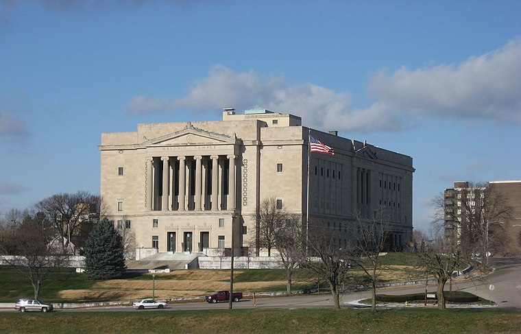
Photo: Nyttend, Public domain.
The Dayton Masonic Center, formerly the Dayton Masonic Temple, is a significant building in Dayton, Ohio. It was built by a Masonic Temple Association formed from 14 Masonic groups.
Dayton Children’s Hospital
Hospital

Photo: DaytonChildrens, CC BY-SA 3.0.
Dayton Children's Hospital stylized as Dayton Children's formerly The Children's Medical Center of Dayton is a pediatric acute care children's teaching hospital located in Dayton, Ohio.
Schuster Performing Arts Center
Arts center

Photo: Jsteeber, CC BY-SA 4.0.
The Benjamin & Marian Schuster Performing Arts Center is located in Dayton, Ohio and was built in 2003 to serve as Dayton's principal venue for performing arts.
Places in the Area
Nearby places include Dayton and Riverside.
Dayton

Photo: MarkDonna, CC BY-SA 3.0.
Dayton is the birthplace of aviation: the Wright brothers, Orville and Wilbur, lived here and perfected their design for the first practical aircraft. It is also home to one of the few multi-site National Parks in the U.S, the Dayton Aviation Heritage Park.
Riverside
Town

Photo: Tony Alter, CC BY 2.0.
Riverside is a city in Montgomery County, Ohio, United States. The population was 24,474 at the 2020 census. A suburb of Dayton, it is part of the Dayton metropolitan area.
Kettering
Town

Photo: Coastermom, CC BY 3.0.
Kettering is a city in Montgomery County, Ohio, United States. It is an inner suburb of Dayton. The city had a population of 57,862 at the 2020 census, making it the most populous suburb in the Dayton metropolitan area.
Deed’s Point
- Type: Cape
- Category: landform
- Location: Montgomery, Ohio, Midwest, United States, North America
- View on OpenStreetMap
Latitude
39.7675° or 39° 46′ 3″ northLongitude
-84.1871° or 84° 11′ 14″ westOpen location code
86FQQR87+X5OpenStreetMap ID
node 8043102032OpenStreetMap feature
natural=cape
This page is based on OpenStreetMap, Wikidata, and Wikimedia Commons.
We’d love your help improving our open data sources. Thank you for contributing.
Satellite Map
Discover Deed’s Point from above in high-definition satellite imagery.
Localities in the Area
Explore places such as Riverdale and McPherson Town Historic District.
Notable Places Nearby
Highlights include Five Rivers Fountain of Lights and Five Rivers Fountain of Lights.
Ohio: Must-Visit Destinations
Delve into Columbus, Cincinnati, Cleveland, and Bowling Green.
Curious Capes to Discover
Uncover intriguing capes from every corner of the globe.
About Mapcarta. Data © OpenStreetMap contributors and available under the Open Database License". Text is available under the CC BY-SA 4.0 license, except for photos, directions, and the map. Photo: Wikimedia, CC0.