Cova de les Avellanes
Cova de les Avellanes is a cave in Les Avellanes i Santa Linya, Lleida, Catalonia. Cova de les Avellanes is situated nearby to the ruins Cabana del Teixidor, as well as near the peak Pedra Blava.| Tap on a place to explore it |
Places of Interest Nearby
Highlights include Sant Miquel de Tartareu and Santa Maria de Tartareu.
Sant Miquel de Tartareu
Church
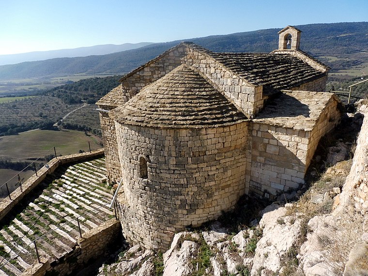
Photo: Isidre blanc, CC BY-SA 4.0.
Sant Miquel de Tartareu is a church, which is situated 2½ km northwest of Cova de les Avellanes.
Santa Maria de Tartareu
Church

Photo: Isidre blanc, CC BY-SA 4.0.
Santa Maria de Tartareu is a church, which is situated 2½ km northwest of Cova de les Avellanes.
Malera
Peak

Photo: Isidre blanc, CC BY-SA 4.0.
Malera is a peak, which is situated 3 km northwest of Cova de les Avellanes.
Places in the Area
Nearby places include Tartareu and Vilamajor.
Tartareu
Hamlet

Photo: Isidre blanc, CC BY-SA 4.0.
Tartareu is a hamlet, which is situated 2½ km northwest of Cova de les Avellanes.
Vilamajor
Hamlet

Photo: Isidre blanc, CC BY-SA 4.0.
Vilamajor is a hamlet, which is situated 3½ km north of Cova de les Avellanes.
Os de Balaguer
Village

Photo: Amadalvarez, CC BY-SA 3.0.
Os de Balaguer is a municipality in the comarca of Noguera, in the province of Lleida, Catalonia, Spain. It has a population of 1,075. Economy is based on agriculture, with, in particular, the cultivation of vegetables, cereals and olive, and on animal husbandry as well. Os de Balaguer is situated 4½ km southwest of Cova de les Avellanes.
Cova de les Avellanes
- Type: Cave
- Category: landform
- Location: Les Avellanes i Santa Linya, Lleida, Catalonia, Eastern Spain, Spain, Iberia, Europe
- View on OpenStreetMap
Latitude
41.90709° or 41° 54′ 26″ northLongitude
0.74311° or 0° 44′ 35″ eastElevation
605 metres (1,985 feet)Open location code
8FH2WP4V+R6OpenStreetMap ID
node 8085843395OpenStreetMap feature
natural=cave_entrance
This page is based on OpenStreetMap, Wikidata, and Wikimedia Commons.
We’d love your help improving our open data sources. Thank you for contributing.
Satellite Map
Discover Cova de les Avellanes from above in high-definition satellite imagery.
In Other Languages
“Cova de les Avellanes” goes by many names.
- Catalan: “Cova de les Avellanes”
Notable Places Nearby
Highlights include Cabana del Teixidor and Pedra Blava.
Nearby Places
Explore places such as Corral del Claret and Cabana de l’Elena.
Lleida: Must-Visit Destinations
Delve into Lleida, Val d’Aran, La Seu d’Urgell, and Aigüestortes i Estany de Sant Maurici National Park.
Curious Caves to Discover
Uncover intriguing caves from every corner of the globe.
About Mapcarta. Data © OpenStreetMap contributors and available under the Open Database License". Text is available under the CC BY-SA 4.0 license, except for photos, directions, and the map. Photo: Wikimedia, CC0.